Catalog Archive
Auction 158, Lot 271

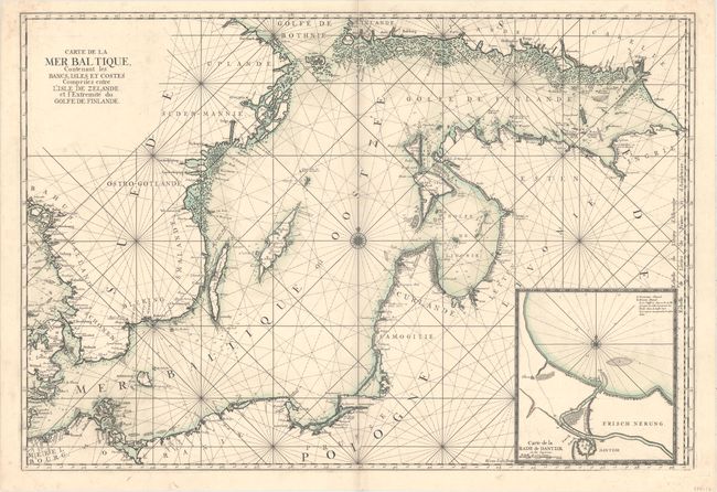
"Carte de la Mer Baltique, Contenant les Bancs, Isles et Costes Comprises Entre l'Isle de Zelande et l'Extremite du Golfe de Finlande", Loon, Herman van

Subject: Baltic

Period: 1693 (circa)

Publication: Le Neptune Francais

Color: Hand Color

Size:
35.2 x 24.1 inches
89.4 x 61.2 cm
Download High Resolution Image
(or just click on image to launch the Zoom viewer)

This superb, large sea chart of the Baltic Sea is filled with detail along the coastlines including mountains, cities and forests. A large inset depicts the harbor and entrance to the city of Dantzig. The map is centered on a compass rose with radiating rhumb lines. This chart was initially created for Jaillot's Neptune Francois and subsequently was incorporated into publications by Bellin for the Depot de la Marine. Engraved by Herman van Loon, whose imprint appears adjacent to the inset. An uncommon chart that is rarely found in such excellent condition.

References: Pastoureau, NEPTUNE FRANCAIS A [2].

Condition: A

A dark impression with original outline color on a sheet with a "B Colombier" watermark. There is a printer's crease along centerfold at top and very minor soiling.

Estimate: $1,100 - $1,400

Sold for: $650

Closed on 6/22/2016

Archived