Subject: Britain
Period: 1646 (circa)
Publication: Guil. et Ioannis Blaeu Theatrum Orbis Terrarum, sive Atlas Novus - Part IV
Color: Hand Color
Size:
19.8 x 15.3 inches
50.3 x 38.9 cm
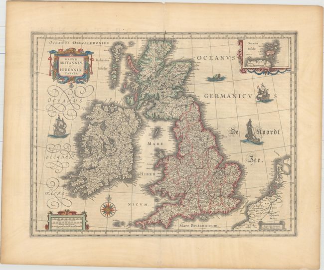
This handsome map of the British Isles is believed to be printed from the revised plate of Hondius' carte-a-figures map of 1630. Blaeu acquired a number of Jodocus Hondius' plates from Hondius' widow in 1629. As this map was too large to fit in Blaeu's atlas, it is presumed that he removed the surrounding panels. It is filled with minutely engraved topographical and political detail of England, Wales, Ireland and Scotland, and is inset with a small map of the Orkney Islands. The map appeared in many of the Blaeu atlases between 1634 and 1672 and was included in all editions of the Blaeu atlas of England and Wales from 1645 onwards. It is decorated with a lovely compass rose, and a decorative scale of miles and title cartouche. Three delicately engraved ships and a large sea monster complete the composition. Latin text on verso, published between 1646-62. A crack is visible in the plate along the centerfold in the top border.
References: Moreland & Bannister, p. 217; Shirley (BI to 1650) #423; Van der Krogt (Vol. II) #5000:2.2.
Condition: B+
A nice impression on watermarked paper with minor toning and soiling. Very nearly an "A" example.