Subject: Eastern Brazil
Period: 1647 (circa)
Publication:
Color: Hand Color
Size:
21.1 x 16.4 inches
53.6 x 41.7 cm
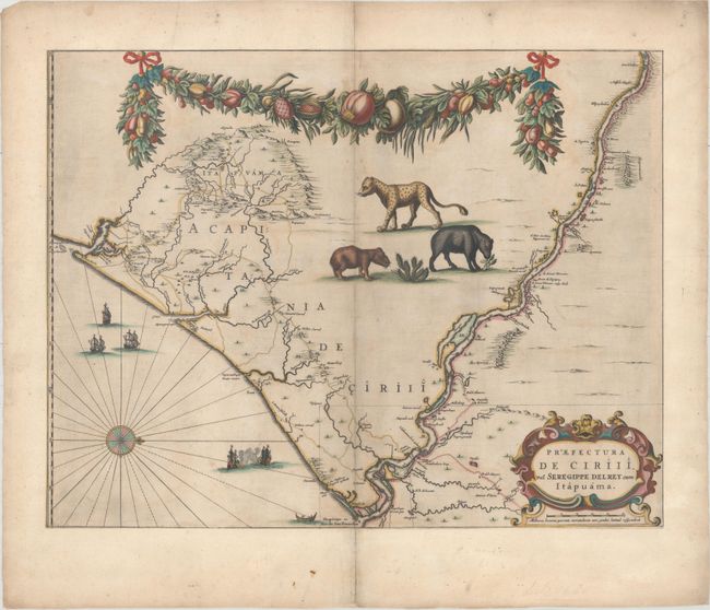
This fine map of the Brazilian coast is adorned with a massive garland across the top bearing plenty of native fruit and a jaguar, tapir, and capybara. With north oriented to the right, the map covers the coastal region from Sao Francisco south to the mouth of the Vaza-Barris River. The map traces the rivers inland with place names and topographical detail along their shores. There is a naval skirmish, three Dutch ships, and a canoe off the coast in the Atlantic. It was drawn after actual surveys by Georg Marcgraf, Elias Herckmanns, and others and was among the first maps of Brazil based on non-Portuguese data. Blaeu first issued this and its companion maps in 1647 for Gaspar Barleus' Rerum per octennium in Brasilia. They were also assembled into a large wall map, Brasilia qua parte paret Belgis. The maps then appeared in the Atlas Maior beginning in 1662. This example has a blank verso.
References: cf. Goss (Blaeu) pp. 184-185; Van der Krogt (Vol. II) #9850/1:2D; Whitehead (TMC-40) pp. 17-20.
Condition: B+
Original color. This example has been trimmed to neatline and mounted on period correct paper with the number 51 printed on the back, indicating that this was likely included in a composite atlas. There light soiling and light scattered foxing.