Subject: St. Vincent, Barbados
Period: 1859 (circa)
Publication: The Philips New General Atlas
Color: Hand Color
Size:
23.9 x 20 inches
60.7 x 50.8 cm
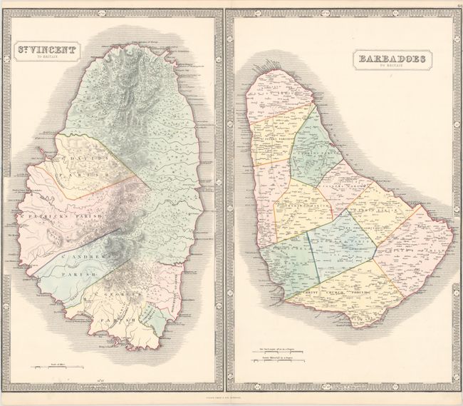
This sheet contains two handsome maps showing St. Vincent and Barbados. At left, the map of St. Vincent shows excellent topographical detail of this mountainous and volcanic island. The island is divided into four parishes -- St. David, St. Patrick, St. Andrew, and St. George -- with the northern portion of the island labeled Caribs Lands. In St. George's Parish are Kingstown, the capital of St. Vincent and the Grenadines, and the Botanical Garden. Established by the British in 1765, the Botanic Gardens is the second oldest in the Western Hemisphere and is still today a popular attraction on the island. At right, the map of Barbados is split into 11 parishes, with plenty of settlements and churches named.
References:
Condition: B+
Original color. The margins have been trimmed to neatline at left and right by the binder, but without loss of image.