Subject: Lesser Antilles
Period: 1821 (circa)
Publication: New General Atlas
Color: Hand Color
Size:
23.4 x 19.8 inches
59.4 x 50.3 cm
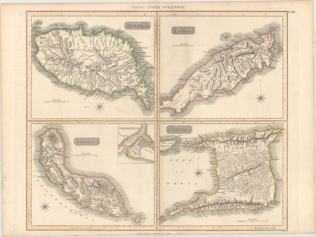
This sheet features four maps showing Grenada, Tobago, Curacao, and Trinidad. Each includes intricate topographical detail, place names, and a compass rose. Grenada is divided into six quartiers, and its roads are depicted. Tobago is split into seven divisions, and its roads are also shown. The island's prominent forest contains a note that reads, Reserved in Wood for Rains. On the map of Curacao, plantations, salt pans, ponds, and ruins are located. Two notes indicate where the French landed by Fort Amsterdam in 1672 and south of St. John's Haven in 1713. An inset plan of Fort Amsterdam appears at top right. Trinidad's royal highway is traced, and a note in the middle of the island warns, "All the Inland Part is covered with impenetrable Woods." Thomson's publishing business prospered between 1813 and 1869. His maps are noted for their accuracy, strong impression and fine engraving. Engraved by Neele.
References:
Condition: B+
Original outline color on paper with an "1815" watermark and minor toning along the centerfold and along the sheet's edges. An edge tear entering the Trinidad map at bottom has been closed with archival tape.