Subject: Gulf of Mexico & Caribbean
Period: 1720 (circa)
Publication:
Color: Hand Color
Size:
22.2 x 18.2 inches
56.4 x 46.2 cm
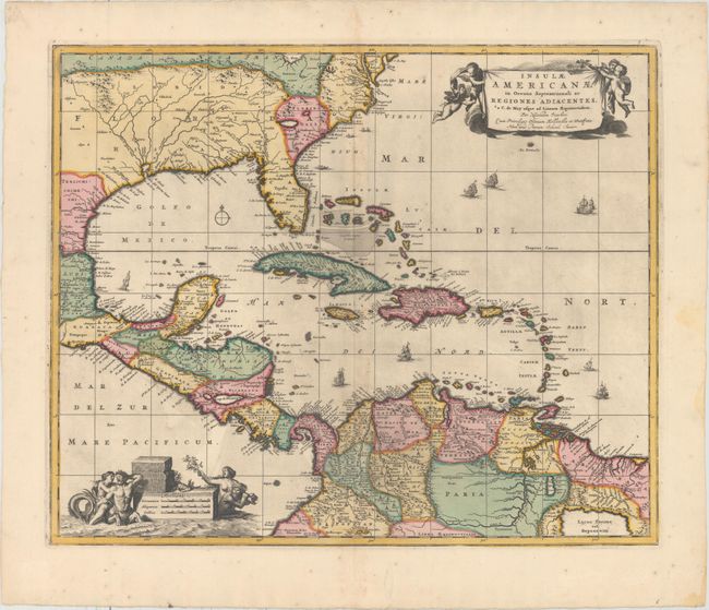
This handsome map focuses on the West Indies and covers the region from the Chesapeake through the Gulf of Mexico, with Central America and the northern part of South America. Two lovely cartouches with cherubs and mermaids decorate opposite corners. Eight ships sail the seas, and three native canoes are depicted off the coast of North America. A number of interesting cartographic myths appear on the map. These include two large nonexistent lakes in the region of western Georgia and a non-existent mountain range extending from the Piedmonts bearing across the North American continent. In South America, the archetypal cartographic myth, Manoa o' El Dorado (the Golden City), is located on the shores of the Lacus Parime vel Roponowini in Guyana. This is the fourth state with retouched cartouches and the addition of Schenk's name to the title cartouche.
References: Burden #531; cf. Portinaro & Knirsch #82.
Condition: B+
Full original color with light printer's ink residue and minor toning along the centerfold. One short tear in the image has been closed on verso with archival material. There are some minor spots and damp stains confined to the blank margins.