Subject: Gulf of Mexico & Caribbean
Period: 1652 (circa)
Publication: Nouvel Atlas ou Theatre du Monde...
Color: Black & White
Size:
20.3 x 14.8 inches
51.6 x 37.6 cm
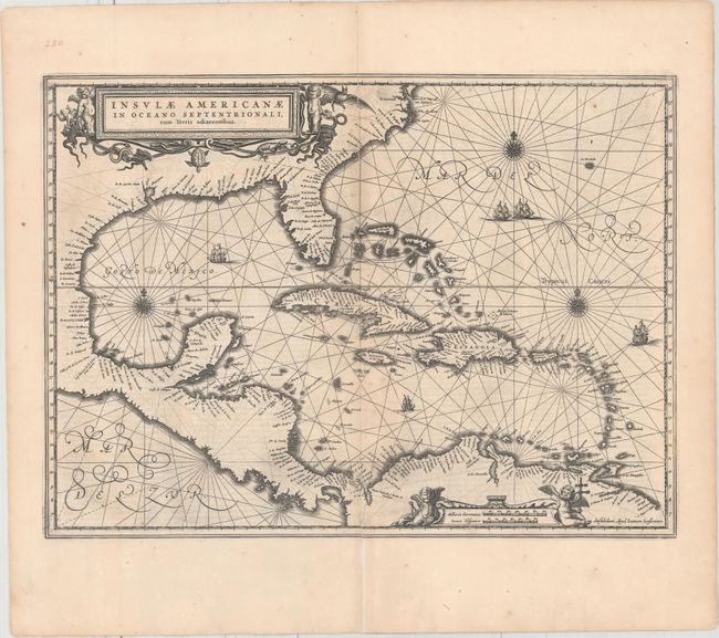
This handsome map focuses on the West Indies and covers the region from the Chesapeake through the Gulf of Mexico, with Central America and the northern part of South America. Details are confined to the coastlines. Cartographically it is based on the extremely rare chart of Hessel Gerritsz from 1631 and is nearly identical to Blaeu's map of the same title. This is the first state of this map, French text on verso, published in between 1652-58. Lovely title and scale of miles cartouches, rhumb lines, compass roses, and sailing ships make this a very attractive map. This example has an additional sheet of text attached, encompassing the entire section of text on the Gulf of Mexico and Caribbean.
References: Burden #248; Van der Krogt (Vol. I) #9600.1.
Condition: B+
A dark impression with minor show-through of text on verso, printer's ink residue, a few small spots, and a centerfold separation at top that has been repaired on verso with one inch still separated in the blank margin.