Catalog Archive
Auction 158, Lot 163

"Mexico and Guatemala, Shewing the Position of the Mines", Wyld, James

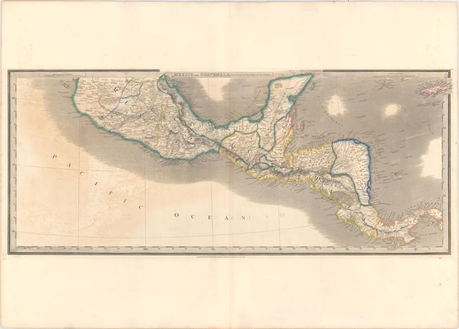
Subject: Central America

Period: 1843 (dated)

Publication:

Color: Hand Color

Size:
31.8 x 13.2 inches
80.8 x 33.5 cm
Download High Resolution Image
(or just click on image to launch the Zoom viewer)

This map of Central America extends from the southern half of Mexico to Panama and includes the Grand Cayman, Little Cayman, and Jamaica. The map is filled with detail, including political boundaries, place names, rivers, and topography shown by hachure. Nicaragua is divided into two, with the larger eastern portion labeled Mosquito Coast. Panama is also called Colombia, and British Settlements are noted along the coast of present-day Belize.

References:

Condition: B

There are generous margins with light to moderate offsetting.

Estimate: $275 - $350

Unsold

Closed on 6/22/2016

Archived