Catalog Archive
Auction 158, Lot 155

"Gray's New Map of Richmond Henrico County, Virginia Drawn from Official Surveys", Gray, Ormando Willis & Son

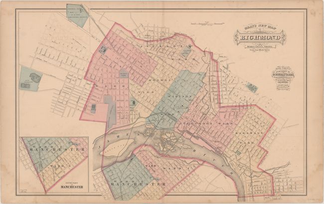
Subject: Richmond, Virginia

Period: 1877 (circa)

Publication: The National Atlas Containing Elaborate Topographical Maps of the United States...

Color: Hand Color

Size:
24.7 x 16.9 inches
62.7 x 42.9 cm
Download High Resolution Image
(or just click on image to launch the Zoom viewer)

This double-page map of Richmond is divided into wards and includes an inset of "South Part of Manchester." Drawn on a scale of 1000 feet per inch, the map notes several important buildings including Capitol Square, Richmond College, Hollywood Cemetery, Central Lunatic Asylum State of Virginia, Virginia Penitentiary, and more.

References:

Condition: B

Light toning and offsetting with damp stains in the bottom corners of the sheet. A few small edge tears are confined to the blank margins.

Estimate: $140 - $170

Sold for: $100

Closed on 6/22/2016

Archived