Subject: Atlases
Period: 1864 (dated)
Publication:
Color: Hand Color
Size:
14.8 x 18.8 inches
37.6 x 47.8 cm
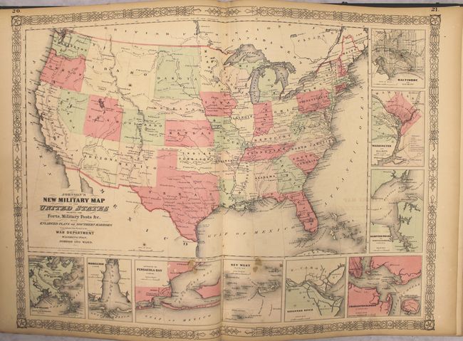
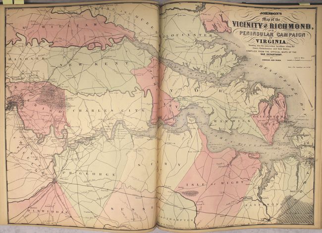
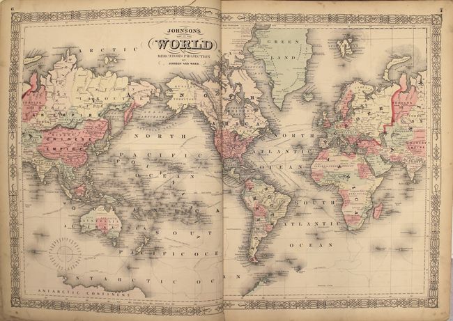
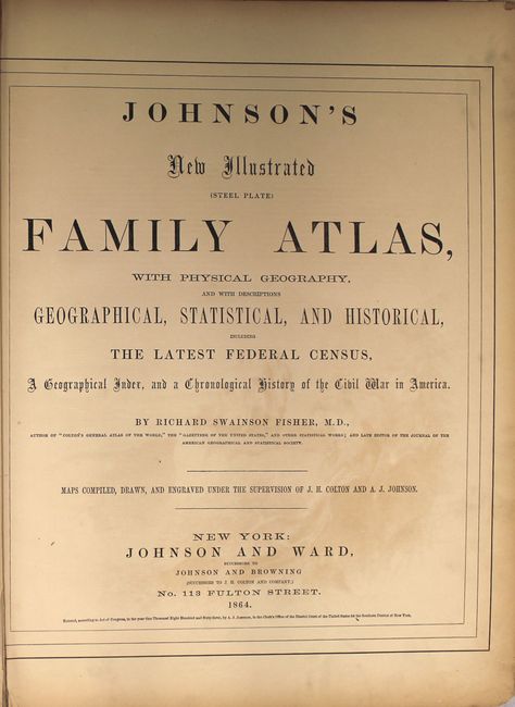
This complete atlas contains 66 beautifully rendered, steel engraved maps, including 34 double-page maps. There are several thematic maps and diagrams interspersed throughout the text that display the geology, weather, tides, agriculture, flags and animal kingdoms of the world. This 1864 edition is the last year with steel engraved plates, with many of the maps featuring vignettes, and some retaining the early strap-work style borders. It also has the desirable edition of the New Military Map of the United States which shows all state and territory boundaries rather than the limits of military divisions. And it features the double-page Civil War map Vicinity of Richmond.
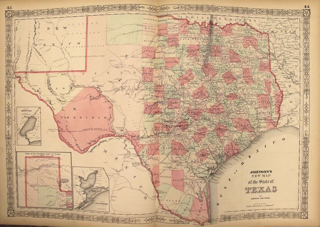
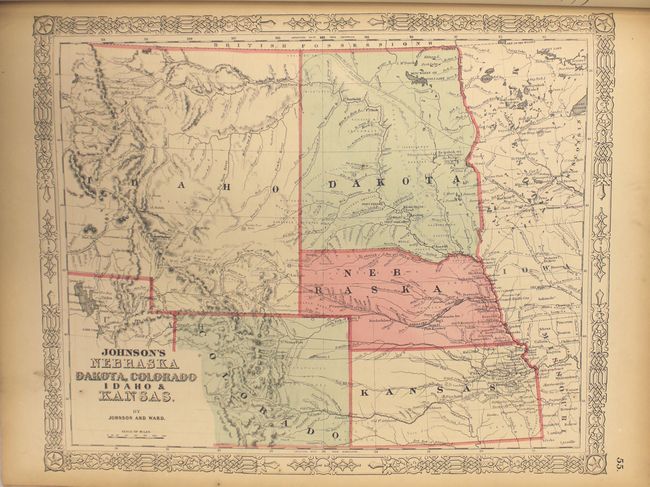
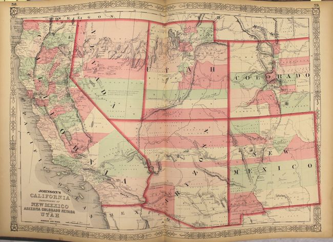
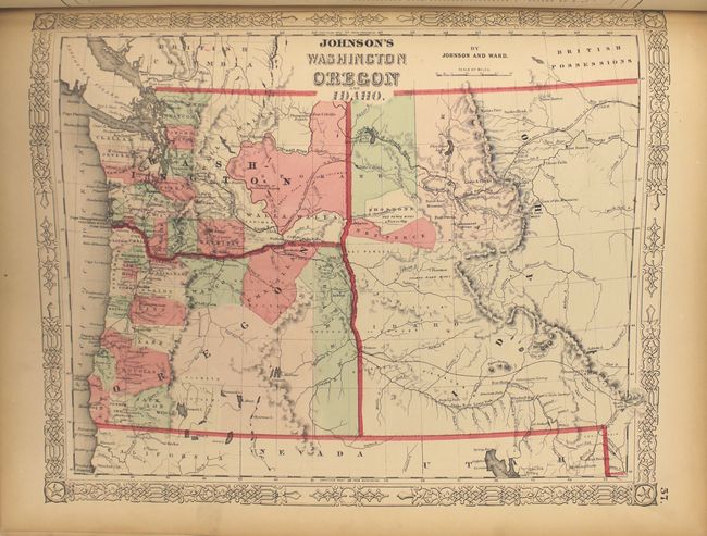
The Southwest map is the late 1863 - early 1864 edition in this series of maps. Arizona still claims the Southern tip of Nevada and has the county configurations of the old New Mexico Territory, with the addition of Castle Dome and Ewell counties in the south. The Utah/Nevada border is now at 115°. This is a completely new plate with extensive revisions in the watershed and mountain detail and several of the earlier notations removed. But it retains the note in the area of Quartzite, Arizona calling the area "exceedingly fertile and abundantly timbered and well watered." The map details the U.S. Mail routes, the Emigrant roads to California, the proposed railroad route through Utah, Nevada and California, and the Pony Express trail. The double-page map of Texas shows county development mostly in eastern Texas and only the three large counties of El Paso, Presidio and Bexar in the west. The panhandle, noted as the Staked Plains (Elevated Table Land, without Wood or Water), includes a large section that is unorganized. There is nice depiction of the wagon roads, many named, with several completed railroads. The inset maps include a 'Plan of Sabine Lake,' 'Plan of the Northern part of Texas,' and 'Plan of Galveston Bay.' The map of the Northwest shows the newly created territory of Idaho. The map of Minnesota shows the newly created region of Dakota with an undefined western boundary.
Folio. Hardbound in original quarter leather with tips and green cloth, embossed covers with gilt titles on cover and spine, marbled end papers.
References:
Condition: B
Overall, the maps are good to very good with light toning, minor foxing, and occasional edge tears. More significant condition issues are more prevalent at the beginning of the atlas including: light offsetting and several small abrasions in the bottom portion of the United States map; 5" centerfold separations at bottom in both the North America and Virginia maps; 2" edge tears at the top of the Eastern Hemisphere and Mercator World maps; a 3" centerfold separation at bottom and 1" edge tears at right and left of the Mountains & Rivers chart. The more important maps of the western United States have no significant flaws other than light toning. Text is very good with light toning, with the exception of the national emblems chart which is heavily chipped and torn. Both covers are detached and are moderately worn and stained.