Subject: Ancient World, Mediterranean
Period: 1649 (circa)
Publication:
Color: Black & White
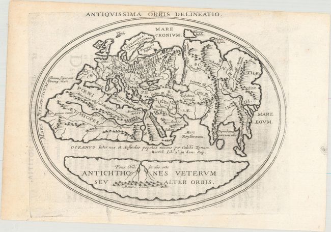
A. Antiquissima Orbis Delineatio (8.0 x 6.4"). This interesting map shows two distinct regions of the earth in antipodean balance. The inhabited Afro-Eurasian continent was balanced by an unknown, and relatively equal, landmass (Antichthones Veterum seu Alter Orbis) on the other side of an impassable torrid zone and a great boiling sea. This notion of antipodean balance and landmass equivalence continued to attract Renaissance cartographers to this otherwise outmoded Roman geographical concept. Distinguished cartographers like Mercator and Ortelius incorporated this model into an immense southern continent (Australis Incongita) to balance the known lands of the world, and the division of the world into climactic zones is still in use today. Latin text on verso with page number 86 at upper left. Condition: There is one tiny wormhole in the image and three others in the blank margin, all repaired on verso with archival material. Faint text show through.
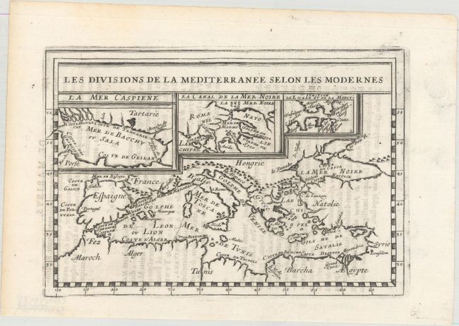
B. Les Divisions de la Mediterranee Selon les Modernes (8.0 x 5.5"). This small map shows the entire Mediterranean Sea and the surrounding countries. Shows good detail of the coastline and the islands in the Mediterranean with insets of the Caspian Sea, Black Sea, and the Strait of Gibraltar. Decorated by a block style title cartouche. Condition: There are two tiny wormholes in the border and one in the blank margin, all repaired on verso with archival material. Faint text show through.
References:
Condition: B+
See descriptions above.