Subject: Southeastern Ohio
Period: 1805 (published)
Publication: The Journal of a Tour into the Territory Northwest of the Alleghany Mountains...
Color: Black & White
Size:
10.4 x 6.3 inches
26.4 x 16 cm
This map and view were issued in Thaddeus Harris' The Journal of a Tour into the Territory Northwest of the Alleghany Mountains:
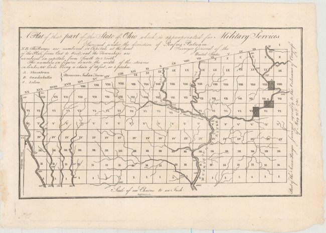
A. A Plat of That Part of the State of Ohio Which Is Appropriated from Military Services. This small plat map covers southeastern Ohio and is divided into Ranges and Townships according to the Congressional Ordinance of 1780 (a precursor to the Public Land Survey System). Locates the Moravian Indian towns of Shoenbrun, Gnadenhutten and Salem as well as the Muskingum River. Surveyed under the direction of Rufus Putnam, Surveyor General of the United States. Despite this early use of townships and ranges, it was not until 1815 that the township plat, a "planimetric base map that laid down legal subdivisions in each township," assumed its modern form. This government land division approach became the standard throughout the Midwest, South, and West in the 19th century.
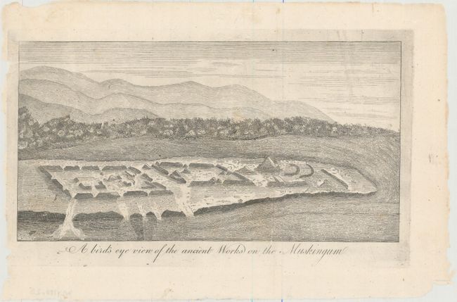
B. A Bird's Eye View of the Ancient Works on the Muskingum. This small view depicts the ancient mounds found by a band of pioneers from the Ohio Company, led by General Rufus Putnam (who would later become Surveyor General of the United States as mentioned above) . This group would form the settlement of Marietta at the confluence of the Ohio and Muskingum rivers, which was the first permanent settlement in the Northwest Territory.
References: cf. Howes #H233.
Condition: A
Dark impressions on clean sheets. Issued folding.