Subject: Tampa Bay, Florida
Period: 1855 (dated)
Publication:
Color: Hand Color
Size:
16.9 x 21 inches
42.9 x 53.3 cm
The Office of Coast Survey is the oldest U.S. scientific organization, dating from 1807 when Congress directed that a "survey of the coast" be carried out. By 1836, it was called the U.S. Coast Survey and in 1878, the name was changed to the U.S. Coast and Geodetic Survey. Today the Office of Coast Survey is a division of the National Oceanic and Atmospheric Administration NOAA.
The survey teams, composed of civilians as well as Army and Naval officers, charted the nation's waterways and produced a wide array of reports, survey charts, hydrographic studies of tides and currents, astronomical studies and observations, and coastal pilots. These charts are an important record of the changing nature of the nation's coastlines. In additional to coastal charts, the U.S. Coast and Geodetic Survey produced land sketches, Civil War battle maps, and the early aeronautical charts.
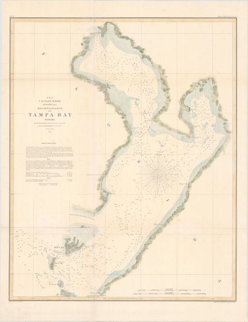
This detailed coastal survey of Tampa Bay is filled with depth soundings and includes sailing directions below the title. The survey was conducted under the direction of Lieut. O. H. Berryman. Drawn by W. Fairfax and engraved by R.T. Knight and R.F. Bartle.
References:
Condition: B+
Issued folding, now pressed and backed in tissue to reinforce folds and repair a few short fold separations. Very light toning and soiling along the folds.