Subject: History Books, Caribbean
Period: 1801 (published)
Publication:
Color: Black & White
Size:
5.9 x 9.4 inches
15 x 23.9 cm
An excellent and full general survey of the peoples, products, government, and history of the islands in the West Indies under British control. It is written from the point of view of a planter and provides information concerning the contemporary conditions, showing the state of affairs after the American war and before the abolition of the slave trade. This is the third edition, with considerable additions including Edwards' report, An Historical Survey of the French Colony in the Island of St. Domingo, together with an Account of the Maroon Negroes in Jamaica, and a History of the War in the West Indies, an autobiographical sketch, and Sir William Young's Tour Through Barbadoes, St. Vincent, Antigua, Tobago, and Grenada, in the Years 1791 and 1792. Edwards' work was very popular, being reprinted numerous times in English, German, French and Spanish. This 3-volume set includes 11 maps:
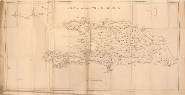
A. A Map of the Island of St. Domingo (35.7 x 17.8"). This large map of Hispaniola gives good detail of the towns, roads, and rivers throughout the island. A dashed line indicates the "Demarcation line between the French & Spaniards as fixed in 1776." Condition: Light offsetting with several misfolds and a 1" tear in an unengraved area due to a misfold. (B+)
B. A Map of the Island of Jamaica, Divided into Counties and Parishes (24 x 12.2"). Condition: Light offsetting with a 1" binding tear at right and minor misfolding. (B+)
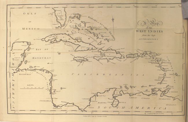
C. A Map of the West Indies from the Best Authorities (15.7 x 9.5"). Condition: Light offsetting with a 1" binding tear at right and minor misfolding. (B+)
D. Map of the Island of Grenada (7 x 9.2"). Condition: Minor offsetting. (A)
E. Map of the Island of St. Vincent (7.2 x 9.3") Condition: Minor offsetting with some foxing. (B)
F. Map of the Island of Dominica (7.1 x 9.2"). Condition: Light offsetting. (B+)
G. Map of the Island of St. Christopher's (9.2 x 7.2"). Condition: Light offsetting. (B+)
H. Map of the Island Antigua (9.1 x 7.2"). Condition: Light offsetting. (B+)
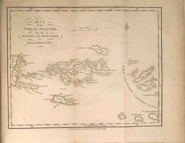
I. Map of the Virgin Islands (8.8 x 6.8"). Condition: Light offsetting and a few spots of foxing. (B+)
J. Map of the Island of Barbadoes (7.2 x 9.1"). Condition: Light offsetting. (B+)
K. Map of the Island of Tobago (8.8 x 7"). Condition: Light offsetting. (B+)
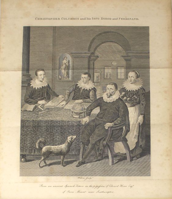
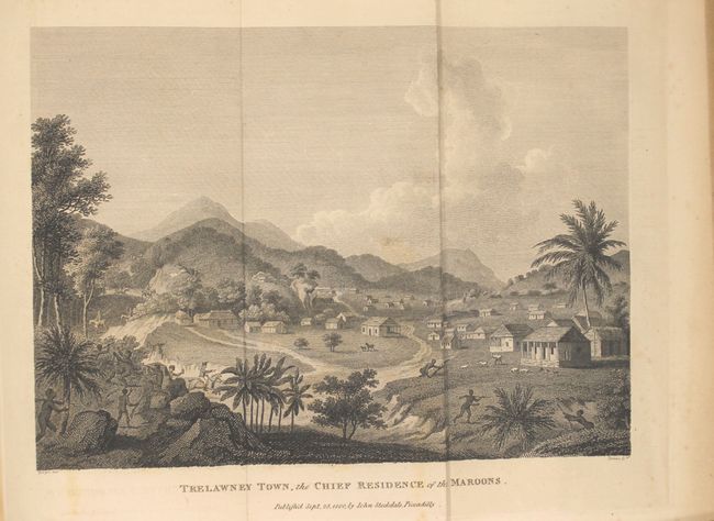
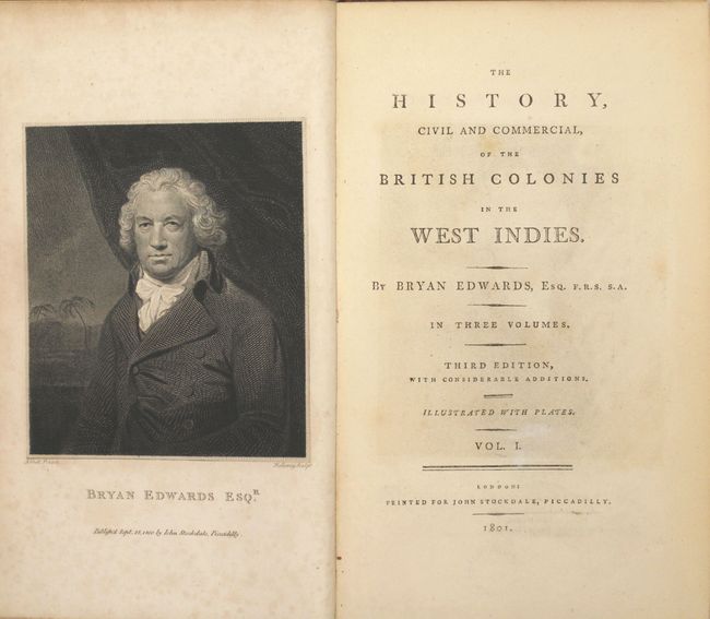
There are 9 (of 11) plates, including a portrait of Bryan Edwards, Columbus and his two sons, bread fruit of Otaheite, an Indian Cacique Addressing Columbus, A Family of the Red Charaibes in the Island of St. Vincent, Pacification with the Maroons, View of Trelawney Town, a Negro Festival, and a Plan of a Sugar Mill. The two missing plates are The Voyage of the Sable Venus and Chatoyer and his Five Wives.
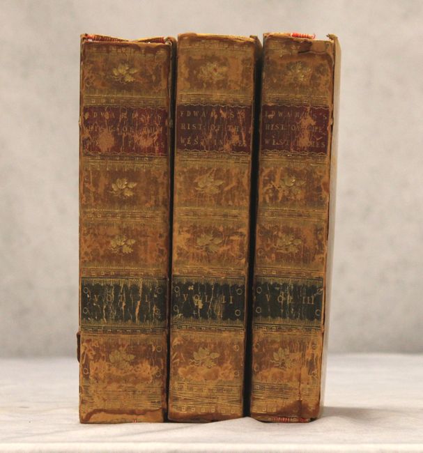
3 volumes, 8vo, pp. xxiv, xxiii, 576; viii, 617; pp. xxxii, 477. Original tree calf binding, elaborately gilt spines with red and black leather title labels.
References: Sabin #21901.
Condition: B+
Maps and engravings generally very clean and bright with light offsetting. See above for additional details on each map. Text is also clean and bright with occasional light foxing. All of the hinges are starting and several covers are nearly detached. Splits at spines on all volumes with some wear on the covers. This is a nice example of this rare work.