Subject: Atlases
Period: 1679 (published)
Publication:
Color: Black & White
Size:
7.6 x 9.8 inches
19.3 x 24.9 cm
Nicolas Sanson was one of the foremost French cartographers of the 17th century, and is often considered the "father" of French cartography. By around 1640, the French market in maps and atlases surpassed that of the Dutch, thereby initiating the Golden Age of French cartography. Born in Abbeville in December 1600, Nicolas Sanson was educated by the Jesuits in nearby Amiens. He studied history, and it is believed that he turned to cartography simply as a means to illustrate history. His maps soon came to the attention of Cardinal Richelieu, King Louis XIII's chief minister, and Sanson was asked to tutor the king in geography. Louis XIII later appointed Sanson "Geographe Ordinaire du Roy" (Geographer to the King). This appointment helped both expand and protect Sanson's role in the French map market. After a failed partnership with Melchoir Tavernier, an engraver and dealer of maps in Paris, Sanson began to edit and publish his work on his own. The most significant works that Sanson edited on his own were his quarto atlases of the four continents - L'Europe, L'Asia, L'Afrique, and L'Amerique - which he published beginning in 1647.
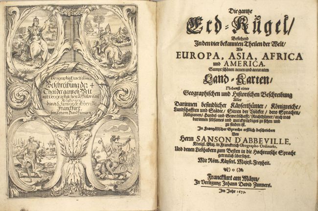
This is the German edition of Sanson's quarto atlas of the world, Description de Tout l'Univers, published by Johann David Zunner. The maps for this edition were re-engraved based on Sanson's original quarto maps. This atlas covers all four continents with a total of 63 maps:
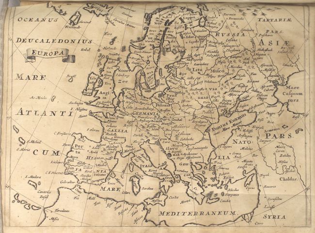
Europe (13 maps): Europe; British Isles; Denmark & southern Sweden; Scandinavia; Russia; France; Germany; Low Countries; Poland & Lithuania; Spain & Portugal; Italy; Greece; Hungary & Balkans
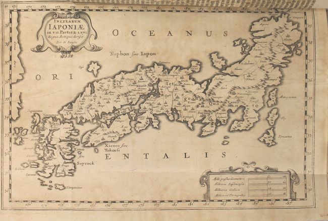
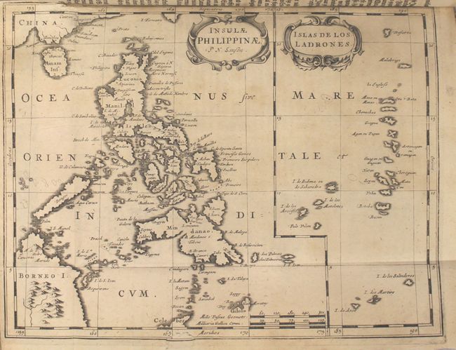
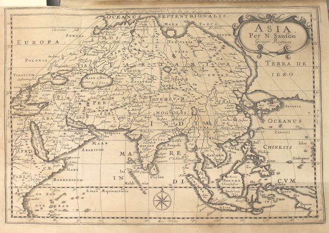
Asia (17 maps): Asia; Turkey in Asia; Anatolia; Middle East; Caucasus & Caspian regions; Arabia; Persia; Southeast Asia [2 maps on sheet]; northern India; southern India; China; Tartary; Japan; Philippines & Ladrones [2 maps on sheet]; East Indies [with insets]; Indonesia; Ceylon & Maldives
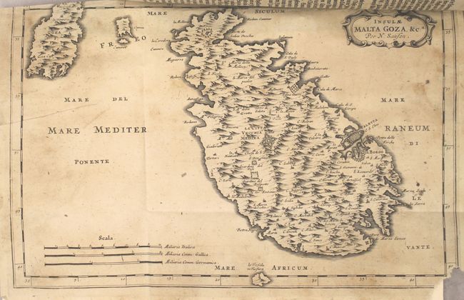
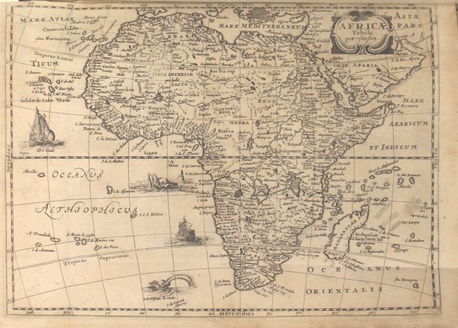
Africa (18 maps): Africa; western Africa; Morocco (southern); Morocco (northern); Algeria; Tunisia & Libya; Egypt & westward; west Africa (northern); Egypt; west Africa (southern); Guinea; Ethiopia & Sudan; Horn of Africa & Zanzabar coast [2 maps on sheet]; Congo; southern Africa; Madagascar; Canary Islands; Malta
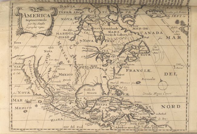
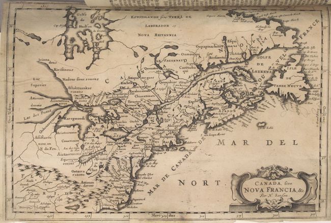
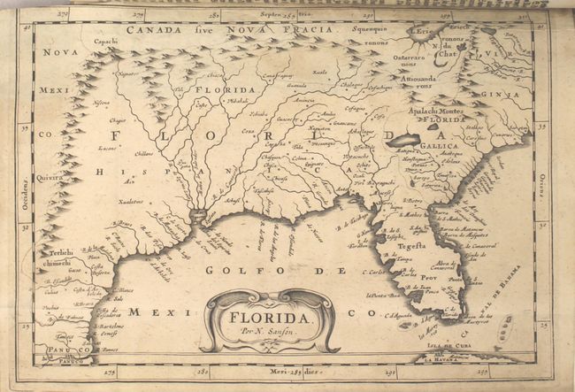
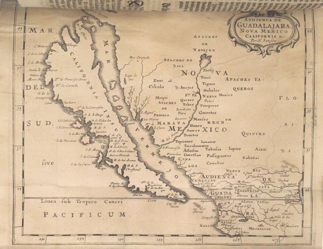
America (15 maps): West Indies; North America; Canada & Northeastern US; Southern US to Texas; southern Mexico; northern Mexico with insular California; Central America; South America; Colombia & Venezuela; Guiana; Peru & Amazonia; Chili; Brazil; La Plata region; Patagonia & Tierra del Fuego
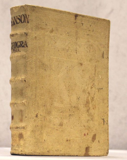
Each map is accompanied by text describing the region. The atlas also includes a lovely frontispiece depicting female representations of the four continents. Blind-stamped vellum over boards with raised bands and "Sanson Geographia" inked to spine.
References: Pastoureau, SANSON VII E.
Condition: B
The majority of the maps are in good condition, with light to moderate damp staining and foxing, and occasional minor edge tears. Several of the maps have tears or chips in the blank margins that have been professionally repaired. A few of the maps are in very good condition. The text is partially damp stained. The front hinge is starting and the covers are lightly stained and worn.