Subject: Africa
Period: 1641 (circa)
Publication: Novus Atlas
Color: Hand Color
Size:
22 x 16.3 inches
55.9 x 41.4 cm
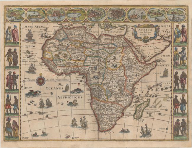
This is one of the most decorative seventeenth century maps of the African continent and a superb example of the Dutch carte-a-figures style. The map is surrounded on three sides with vignettes of native peoples and nine principal cities. The Nile is shown according to Ptolemy with its sources arising in the lakes Zaire and Zaflan, the fictitious Lake Sachaf of Laurent Fries appears, as well as the R. de Spirito Santo. The map is further embellished with numerous ships, sea monsters (including a great seahorse), a compass rose and exotic animals wandering all over the continent. This is the second state of the map. German text on verso, published between 1641-42.
References: Betz #57.2; Norwich #32; Van der Krogt (Vol. II) #8600:2.
Condition: B+
A nice impression with light toning and soiling and faint offsetting adjacent to southern Africa. There are professional repairs to several centerfold separations, two tiny worm holes in the Atlantic, and a number of small chips and tears in the blank margins. A long crease at bottom right has been pressed and professionally reinforced.