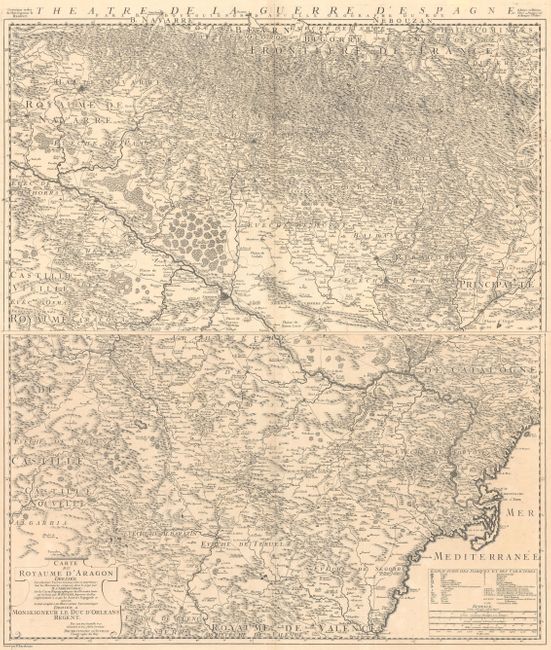
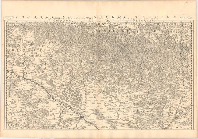
Subject: Northeastern Spain
Period: 1719 (dated)
Publication:
Color: Black & White
Size:
29.8 x 17.6 inches
75.7 x 44.7 cm
This very rare two-sheet map of the Aragon region was published to show the Spanish theater of war during the War of the Quadruple Alliance, in which Spain was defeated by an alliance of Britain, France, Austria, and the Dutch Republic. After losing all of the Spanish possessions in Italy and the Low Countries in the Treaty of Utrecht at the end of the War of the Spanish Succession, King Philip V of Spain set out to retake territories in Italy and to claim the French throne. In 1719, the Duc d'Orleans ordered the French army to invade portions of the Basque region in northern Spain in retaliation for Cardinal Alberoni's plot to overthrow the Duc d'Orleans. Centered approximately on Zaragoza, the map extends from Castello de la Plana in the south to the border with France in the north, and just west of Pamplona. Roads criss-cross the region, and an extensive legend identifies cities, villages, universities, archbishoprics, and much more. Engraved by P. Starkman.
References:
Condition: A
A dark, crisp impressions on watermarked paper with a hint of offsetting along the centerfold. The northern sheet has one small spot at bottom right, and the southern sheet has two small worm holes and one spot in the top blank margin.