Subject: Tierra del Fuego, Le Maire Strait, Isla Alejandro Selkirk
Period: 1780-87 (circa)
Publication:
Color: Black & White
Captain James Cook (1728-1779) is best known for his three voyages to the Pacific (1768-71; 1772-75; and 1776-79). His discoveries radically changed the western understanding of the world in the late 18th century. He was the first to circumnavigate and chart New Zealand and provided the earliest European accounts of exploration along the eastern coast of Australia and the Hawaiian Islands. On February 14th, 1779, he was killed on Hawaii after attempting to kidnap the chief of the island.
Many contemporary accounts of Cook’s voyages, including charts and engravings, appeared in the late 18th century. The first official account of Cook’s first voyage was published in 1773 by John Hawkesworth in Volumes II and III of An Account of the Voyages Undertaken by the Order of His Present Majesty for Making Discoveries in the Southern Hemisphere... William Strahan and Thomas Cadell published the first official accounts of the second and third voyages in 1777 and 1784. Accounts of his exploration were subsequently translated into French, German, and Dutch.
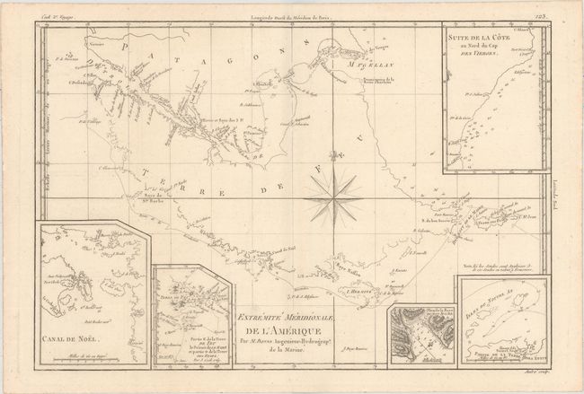
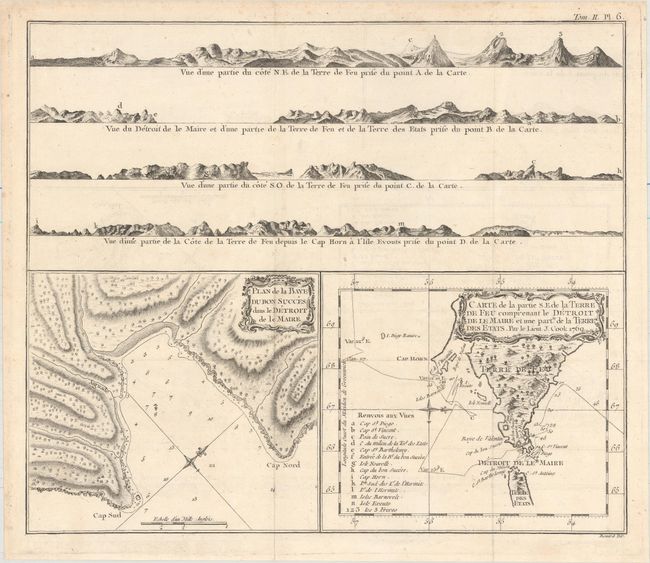
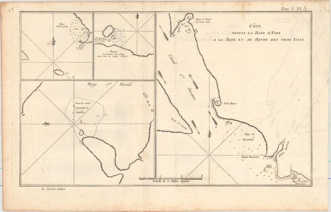
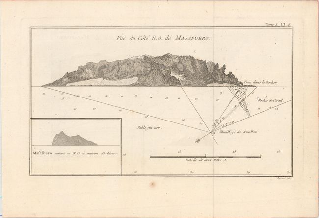
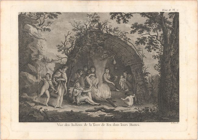
This lot covers Tierra del Fuego, Le Maire Strait, and Isla Alejandro Selkirk in southern South America, areas explored by Captain Cook during his first voyage (1768-71). In addition to two charts, the second sheet includes four coastal perspectives. The four charts feature soundings, bays, rocks, anchorages, and small islands. The view depicts several natives of Tierra del Fuego gathered around a fire in a hut.
A. Extremite Meridionale de l'Amerique, by Rigobert Bonne, from Atlas Encyclopedique, circa 1787 (13.6 x 9.3"). Condition: A crisp impression with a hint of offsetting. (A)
B. Plan de la Baye du Bon Succes dans le Detroit de le Maire [on sheet with] Carte de la Partie S.E. de la Terre de Feu..., by Cook/Benard, from Relation des Voyages Entrepris par Ordre de Sa Majeste Britannique..., circa 1780 (14.1 x 12.1"). Condition: A nice impression issued folding on watermarked paper with light offsetting and a short fold split. (B+)
C. Cote Depuis la Baye d'York a la Baye et au Havre des Trois Isles, by Captain James Cook, from Relation des Voyages Entrepris par Ordre de Sa Majeste Britannique..., circa 1780 (13.6 x 8.2"). Condition: A dark impression issued folding on watermarked paper with light offsetting and minor scattered foxing, much of it concentrated along the sheet's edges. (B+)
D. Vue du Cote N.O. de Masafuero, by Cook/Benard, from Relation des Voyages Entrepris par Ordre de Sa Majeste Britannique..., circa 1780 (11.9 x 6.8"). Condition: A nice impression issued folding on watermarked paper with minor offsetting and a few faint spots. (A)
E. Vue des Indiens de la Terre de Feu dans Leurs Huttes, by Captain James Cook, from Relation des Voyages Entrepris par Ordre de Sa Majeste Britannique..., circa 1780 (11.3 x 7.9"). Condition: A dark impression on watermarked paper with light scattered foxing and damp stains confined to the blank margins. (A)
References:
Condition:
See description above.