Subject: Western United States & Mexico
Period: 1815 (dated)
Publication:
Color: Hand Color
Size:
31.1 x 25.4 inches
79 x 64.5 cm
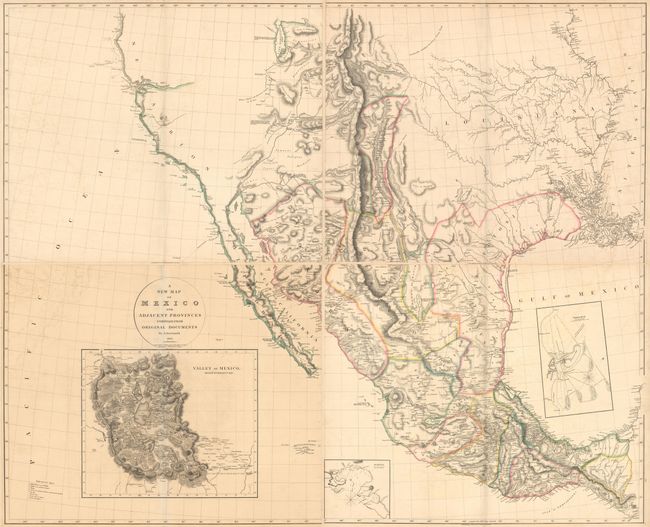
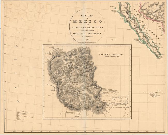
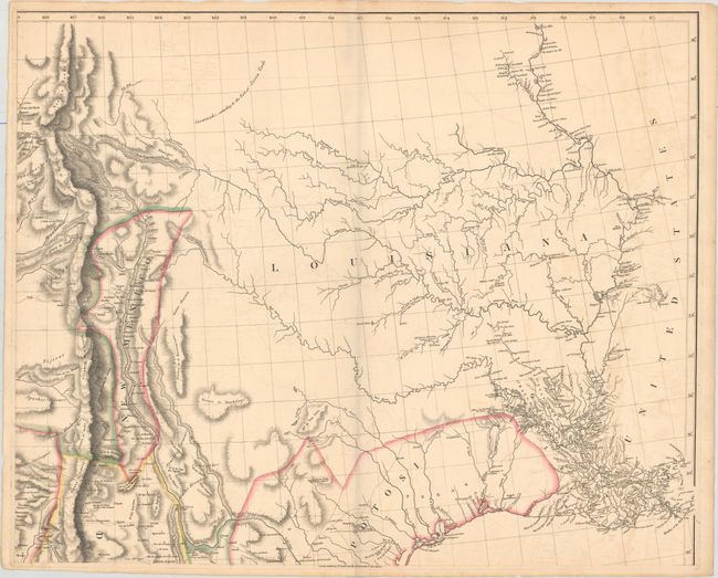
This is one of the most important maps of Texas and the Southwest from the early 19th century. Arrowsmith's map was the first to incorporate the discoveries of both Zebulon Montgomery Pike and Alexander von Humboldt. Pike's official account had just become available in 1810, and Humboldt's map of New Spain was published in 1811. It is not known how Arrowsmith obtained an early copy of Humboldt's map, and Humboldt accused him of plagiarism for neglecting to properly credit his work. However, Arrowsmith's success came from relying on multiple sources of information. He carefully sifted through conflicting data between explorers and incorporated the most accurate cartographical information to create the most accurate, up-to-date map of the region.
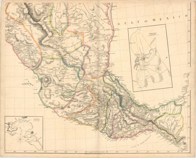
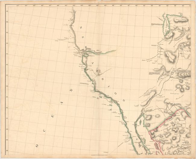
The California coastline was based on the explorations of Vancouver, whose track is noted in the map, as well as information provided to Arrowsmith by the Hudson's Bay Company. The Rocky Mountain region and the Gulf Coast draw primarily on Humboldt, while present-day Texas and the Brazos and Guadalupe River regions were based on Pike's accounts. The Dominguez-Escalante Expedition of 1776 from Santa Fe through present-day Colorado, Utah, and Arizona is also depicted. Additional notes on the mapping of the region are provided throughout the map.
The eastern boundary of US and Mexico extends approximately 50 miles east of the present-day boundary of Texas at the Sabine River, to the Mermentau River in Louisiana. This was the official Spanish stance on the eastern boundary as reported by Humboldt. The boundary follows the Mermentau River to the northeast and then turns to the northwest until it passes the 32nd parallel just south of the Red River, and then begins to head southwest. Between the 99th and 100th meridians, the boundary again turns northwest up to the town of San Saba, which remains under Spanish control. The boundary then again heads southwest until it reaches the Rio del Norte.
The map includes three inset maps of locations in Mexico. Below the title cartouche is the Valley of Mexico, from Mr. Humboldt's Map showing the area surrounding Mexico City with excellent topographical detail, as well as towns, roads, and rivers. The other two insets illustrate the harbors of Veracruz and Acapulco, with numerous soundings, rocks, shoals, anchorages and navigational notes.
The first edition was published in 1810, with further editions with corrections in 1815, 1816, and 1817, with a note in the title indicating the date of the additions. This is the second edition, with additions to 1815. A final edition was published in 1825 with further corrections, including the US-Mexico boundary reflecting the Adams Onis Treaty of 1819, although this edition is still dated 1810, and is occasionally mistakenly identified as the first edition (including by Streeter). According to Martin & Martin, Arrowsmith was able to synthesize the best information from various explorers, while omitting their errors, thereby creating a "significantly improved depiction of the region." Arrowsmith's map of Texas and the southwest is a landmark map that was one of the most influential and widely copied maps for several decades.
Printed on four double elephant-folio sized sheets. Size is for each sheet, which varies slightly. If joined, the map would measure approximately 62 x 50.5".
References: Martin & Martin #25; Streeter #1046A; Wheat (TMW) #295.
Condition: B+
Original outline color on paper with "J. Whatman 1811" watermark. There is light offsetting, minor toning along the edges of the sheets, and a few tiny tears confined to the blank margins. Please note that the image of the map as a whole is a composite image - the four sheets are not joined.