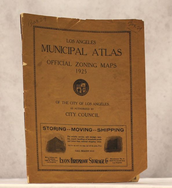
Subject: Los Angeles, California
Period: 1925 (published)
Publication:
Color: Black & White
Size:
9.4 x 12.2 inches
23.9 x 31 cm
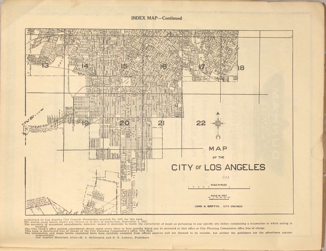
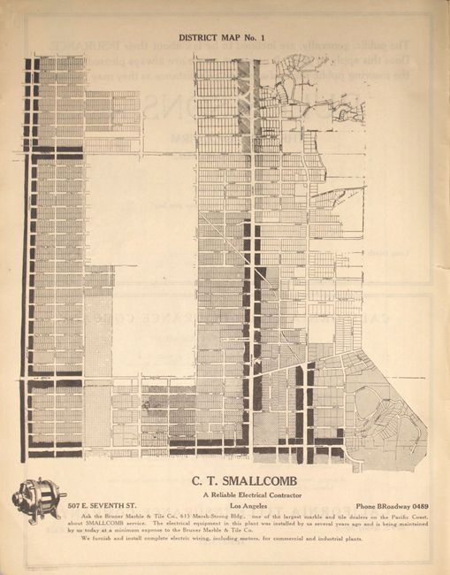
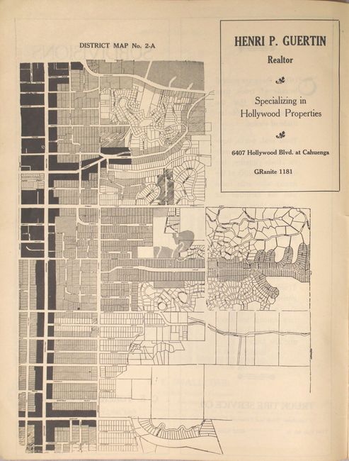
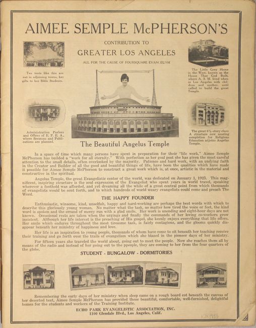
This atlas, published by the Los Angeles city council, contains an index map (on two sheets) of the entire city of Los Angeles and 39 district maps (mostly full page) showing zoning classifications across the city. The legend identifies five zones (color shade in parenthesis): single family housing (white), apartments/hotels (shaded), commercial (black), industrial (spotted) and no classification (crossed). The atlas is filled with numerous advertisements, no doubt to self-fund the publication, including a full-page spread for Aimee Semple McPherson's Angeuls Temple touted as "the great Evangelistic center of the world" as well as many real estate companies. Unpaginated, tan paper wrappers. No sales records in the last thirty years and only 4 examples located on OCLC.
References:
Condition: B+
Overall very good with pleasant even-age toning. A few pages contain small chips or short tears confined to the top blank margin. The wrappers are nearly detached with a number of small chips and tears.