Subject: Western Hemisphere - America
Period: 1832 (dated)
Publication: A Complete Course Of Geography...
Color: Hand Color
Size:
16.9 x 13.6 inches
42.9 x 34.5 cm
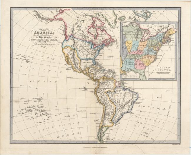
This is a very unusual and interesting map of the Western Hemisphere with a large inset of the United States, engraved for the "Geographical Games." It presents an odd border between Mexico and the United States, and it also displays the British perspective for the boundary with Canada. The large inset shows the eastern United States, which extends to just beyond the Mississippi River. This inset gives a very late depiction of the proposed state of Franklinia. In 1785, settlers in western North Carolina and what would become eastern Tennessee organized a state government to be named in honor of Benjamin Franklin. Congress turned down their appeal but the state maintained a legislature and governor until 1788. This ephemeral state appears on only a small number of maps and this is a late appearance of this frontier political experiment. This scarce map was not included in Baynton-Williams' Map Collector article, "Maps marking the American State of Franklin," (TMC-72, pp12). Engraved by Hewitt.
References:
Condition: A
There is minor soiling and an archivally repaired edge tear in the bottom blank margin.