Subject: Western Africa
Period: 1804 (dated)
Publication:
Color: Hand Color
Size:
21.5 x 17.3 inches
54.6 x 43.9 cm
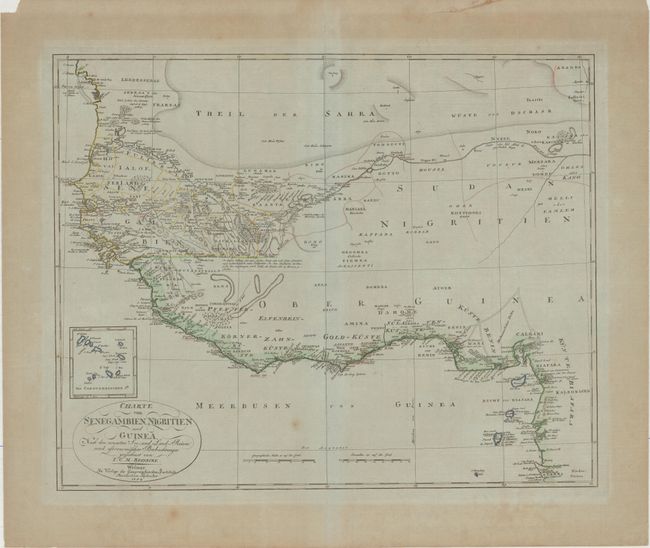
This is an interesting early 19th century German map of the western part of Africa during the period of rapid colonial expansion. Most of the place names appear along the coasts and the Niger River, although there are settlements and topographical elements identified farther inland. The Sahara is prominently shown. An inset above the title cartouche details the Cape Verde archipelago. Published by Weimar Geographisches Institut.
References:
Condition: B+
On a bluish sheet of paper with a small spot in an unengraved area at bottom of map and mat burn confined to the blank margins. There are a couple of tears in the top blank margin and paper tape running along the top edge of the sheet on verso.