Subject: East Indies - Indonesia
Period: 1690 (published)
Publication: Teatro Belgico
Color: Hand Color
Size:
10 x 7.4 inches
25.4 x 18.8 cm
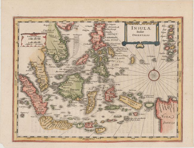
Charming map of the East Indies covers the coast of Indochina and Malaysia with the Philippines and Indonesia. The tip of Malaysian peninsula is bisected with Sincapura shown as an island. The map shows the famous Spice Islands and the important trade capitals of the region. The west coast of New Guinea is exaggerated and the south coastline of Java is indicted only by a dotted line. Decorated with a strapwork title cartouche, scale of miles and a compass rose.
References: Shirley (BL Atlases) G.LETI-2a #43.
Condition: A
A clean and bright example with attractive color and a small chip in bottom left corner of sheet, away from map.