Subject: Puzzle Maps, United States, New York
Period: 1878-1900 (circa)
Publication:
Color:
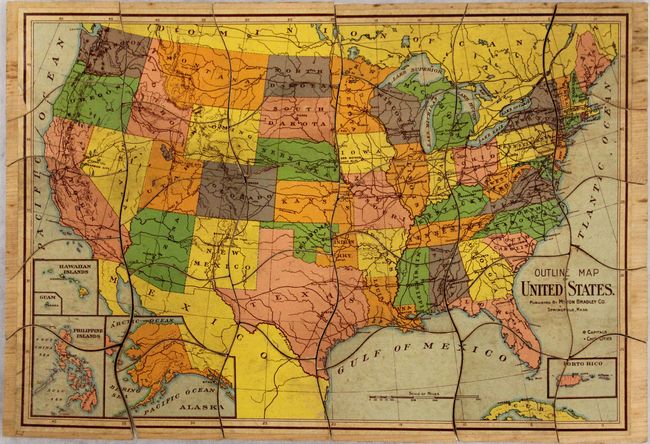
A. Outline Map of United States, by Milton Bradley Co., circa 1900, printed color (14.3 x 9.8"). This complete, 30-piece puzzle map of the United States shows basic details including capital cities, chief cities and railroads. The map is circa 1900 as Indian Territory is still shown. Milton Bradley established his color lithography shop in 1860 and soon thereafter started making board games. During the Civil War he produced small games that soldiers could easily pack in their knapsacks – considered the first American travel games. By the 1870s the company was producing dozens of different types of games and in 1880 began making jigsaw puzzles. Milton Bradley was an early advocate of the idea of kindergarten and many of the company’s products were educational in nature. This is a great example of his work. Condition: Overall very good with minor soiling and toning and a few small chips and abrasions in the image. (B+)
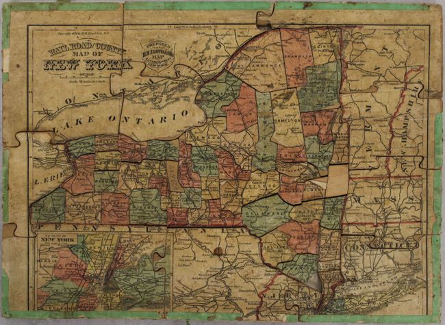
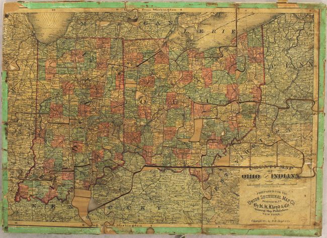
B. Railroad and County Map of New York, by H.H. Lloyd & Co., dated 1878, hand color (16.6 x 12.0"). This two-sided puzzle contains a map of New York on recto and a map of Ohio and Indiana on verso. The puzzle pieces are cut in the shape of New York counties, resulting in some rather small pieces. Includes an inset "Vicinity of New York" at bottom. Condition: Missing one small piece (Rockland County) with the map image missing on several others. Moderate soiling with part of the decorative green border missing. (B)
References:
Condition:
See description above.