Subject: Low Countries
Period: 1666 (dated)
Publication:
Color: Hand Color
Size:
21.4 x 18.3 inches
54.4 x 46.5 cm
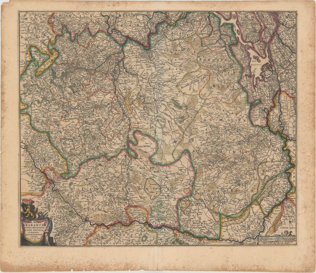
This handsome map centers on the Duchy of Brabant in present-day Netherlands and Belgium, spanning from Rotterdam south to Namur and extending to include part of western Germany. The Meuse River is prominently shown, and a number of towns and cities are located, including Liege, Brussels, Bergen op Zoom, Venlo, and Maastricht. There is nice topographical detail throughout, and roads have been carefully delineated. The title cartouche adorns the bottom left corner and features Brabant's leonine coat-of-arms. A small cartouche for the distance scales appears at bottom right, topped by a putto with a compass.
References:
Condition: B+
A dark impression with full original color, light toning, scattered foxing that is mostly concentrated along the sheet's edges, and centerfold separations in the top and bottom blank margins.