Catalog Archive
Auction 155, Lot 446

"Novissima ac Prae Caeteris Alus Accuratissima Regni et Insulae Hiberniae Delineatio, in qua sunt Lagenia, Ultonia, Connachia, et Momonia Provinciae...", Wit, Frederick de
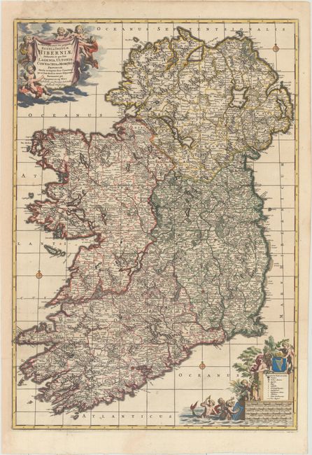
Subject: Ireland

Period: 1680 (circa)

Publication:

Color: Hand Color

Size:
19.8 x 28.1 inches
50.3 x 71.4 cm
Download High Resolution Image
(or just click on image to launch the Zoom viewer)

This handsome two-sheet map of Ireland is filled with details of political boundaries, cities, tiny towns, roads, forested areas, and rivers. The map is embellished with two large cartouches featuring putti. The distance scale cartouche incorporates a legend and is adorned with the coat of arms of Ireland as well as several mer-folk. This is the second state, with the addition of rhumb lines.

References:

Condition: A

A dark, crisp impression with a couple of minor spots, a tiny hole in Dingle Bay, and a professionally repaired tear that just enters map border at bottom. The left margin has been expertly extended to accommodate framing.

Estimate: $800 - $1,000

Sold for: $700

Closed on 11/18/2015

Archived