Subject: North Pole
Period: 1730 (circa)
Publication:
Color: Black & White
Size:
12.7 x 13.4 inches
32.3 x 34 cm
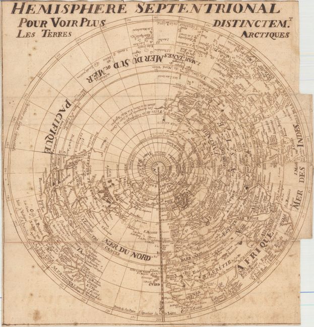
This meticulously drawn French manuscript map depicts the northern hemisphere, and was likely created by a student. The map was copied from Delisle's map of the same title from 1714, although in a reduced size and with slightly less detail in the interior of each continent. Delisle's map was the first map to correctly place the west coast of North America, moving it substantially east from previous mapping. California is shown as a peninsula at a time when it was often still shown as an island. Near the northern coast of Asia is Terre de la Compagnie with a note about its discovery by Jean de Gama (here mistakenly written as Iean de Cama). A delightful rendition of Delisle's fascinating map.
References:
Condition: B
Watermarked paper with light soiling and foxing. There are professional repairs to several short separations along the folds and to two tears that enter 2" and 4" into map at right. There are a number of small cracks in the title and the bold text caused by the oxidation of the ink that have been professionally reinforced on verso.