Subject: Falkland Islands, Tierra del Fuego
Period: 1780 (circa)
Publication: Relation des Voyages Entrepris par Ordre de Sa Majeste Britannique...
Color: Black & White
Captain James Cook (1728-1779) is best known for his three voyages to the Pacific (1768-71; 1772-75; and 1776-79). His discoveries radically changed the western understanding of the world in the late 18th century. He was the first to circumnavigate and chart New Zealand and provided the earliest European accounts of exploration along the eastern coast of Australia and the Hawaiian Islands. On February 14th, 1779, he was killed on Hawaii after attempting to kidnap the chief of the island.
Many contemporary accounts of Cook’s voyages, including charts and engravings, appeared in the late 18th century. The first official account of Cook’s first voyage was published in 1773 by John Hawkesworth in Volumes II and III of An Account of the Voyages Undertaken by the Order of His Present Majesty for Making Discoveries in the Southern Hemisphere... William Strahan and Thomas Cadell published the first official accounts of the second and third voyages in 1777 and 1784. Accounts of his exploration were subsequently translated into French, German, and Dutch.
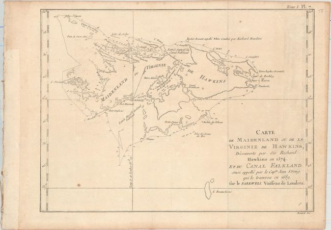
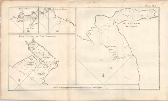
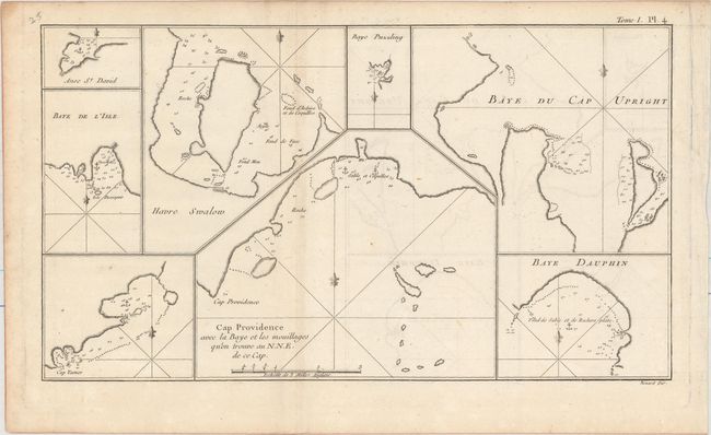
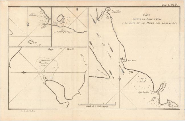
This lot of charts cover the Falkland Islands and the Tierra del Fuego region of Chile, areas explored by Captain Cook during his first voyage (1768-71). The title of the first chart erroneously claims that Sir Richard Hawkins discovered the Falkland Islands in 1574, when he would have been twelve years old. Hawkins did map the northern coastline of what may have been the islands in 1593, but the islands appeared on charts before that date. The map identifies a rock named by Hawkins and traces the track of Capt. John Strong's exploration in 1689, when he discovered the sound in between the two main islands. The remaining three charts depict the intricate network of bays and ports in Tierra del Fuego, with numerous soundings, hazards, anchorages, and more.
A. Carte de Maidenland ou de la Virginie de Hawkins, Decouverte par Sir Richard Hawkins en 1574, et dy Canal Falkland..., (11.8 x 8.8"). Engraved by Benard.
B. Baye et Havre de Cordes [on sheet with] Port Gallant et Baye Fortescue [and] Port Eamine [and] Baye de Wood, (14.9 x 8.3").
C. Cap Providence avec la Baye et les Mouillages qu'on Trouve au N.N.E. de ce Cap, (14.2 x 8.1"). Engraved by Benard.
D. Cote Depuis la Baye d'York a la Baye et au Havre des Trois Isles, (13.6 x 8.2").
References:
Condition: A
All are issued folding on watermarked paper with faint offsetting and a few minor spots of foxing, mostly confined to the blank margins.