Subject: Western South America
Period: 1850 (circa)
Publication: Illustrated Atlas and Modern History of the World
Color: Hand Color
Size:
9.9 x 13.3 inches
25.1 x 33.8 cm
The maps from The Illustrated Atlas were first published in serial form to a target audience that led insular lives due to the expense and hardship of travel. All that changed as the progress of the nineteenth century brought swift and dramatic changes in public awareness of far away places. Tallis' maps no doubt played an important role in this dramatic awakening. These maps not only provided up-to-date geographical knowledge, but also used vignette views within the map's design to show the native people and their occupations, cities and points of interest. The maps hark back to a cartographic tradition from the Dutch mapmakers of the seventeenth century with finely engraved decorative borders. The maps were drawn and engraved by John Rapkin with views drawn and engraved by a number of prominent artists. The maps were issued as a complete volume from 1851 until about 1865. Some of the maps were also published in other history books published by Tallis including British Colonies and, without the vignettes, in geographical dictionaries and encyclopedias until about 1880.
This lot of steel engraved maps covers much of the western coast of South America. Size varies slightly.
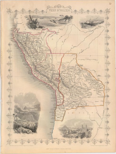
A. Peru & Bolivia. This map features good detail and four beautifully engraved vignettes: Swimming Couriers of Peru, Tarija, Potosi, and Lima. Parts of Ecuador, Brazil, and La Plata are visible but largely unengraved. The illustrations were drawn by H. Winkles and engraved by J.H. Kernot; J. Rapkin drew and engraved the map.
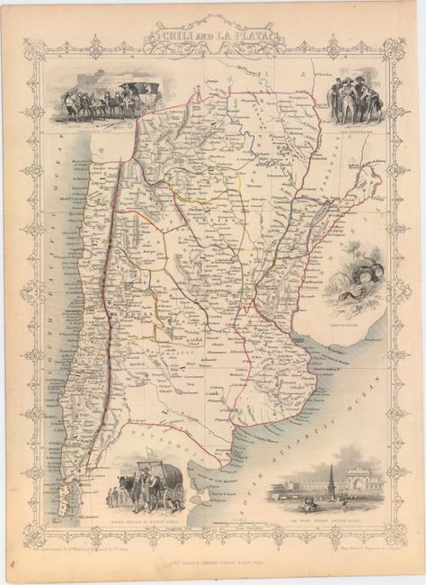
B. Chili and La Plata. The area from southern Bolivia and Paraguay (left mostly blank) down to just south of San Matias Gulf is shown in this finely engraved map. It includes five vignettes: Travelling Post, The Gobernador, Water Seller of Buenos Ayres, a rattlesnake, and the Grand Square in Buenos Aires. The illustrations were drawn by H. Winkles and engraved by W. Lacey; J. Rapkin drew and engraved the map.
References:
Condition: B+
Both maps are on slightly toned sheets with original outline color. Each includes minor soiling and a few faint spots. The first map has small binding holes in the left blank margin.