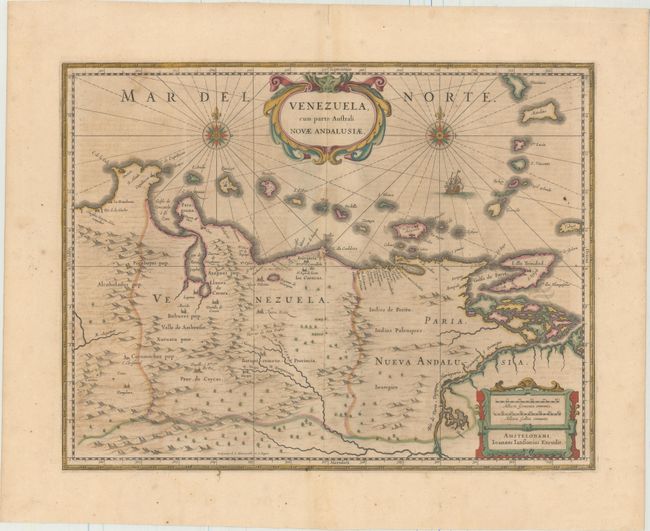
Subject: Venezuela
Period: 1658 (circa)
Publication: Nieuwen Atlas
Color: Hand Color
Size:
19.4 x 14.8 inches
49.3 x 37.6 cm
This beautifully engraved map is Jansson's version based on the cartography of Hessel Gerritsz. It covers the Venezuelan coast of South America, east to the mouth of the Orinoco, and includes the offshore islands from Aruba through Dominica and Tobago. The fine engraving illustrates the mountains, forests, rivers and missions in the interior, but shows place names primarily along the coastlines owing to the relatively few explorations made into the interior. The map is embellished with title and distance scale cartouches, a pair of compass roses and a galleon in the sea. Dutch text on verso, published between 1645-58.
References: Van der Krogt (Vol. I) #9830:1.2.
Condition: B+
A nice impression with full original color and wide margins. There is light toning, minor color offsetting, and a few small spots of foxing.