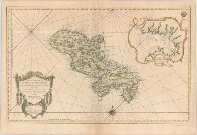
Subject: Martinique
Period: 1758 (dated)
Publication: Hydrographie Francoise...
Color: Hand Color
Size:
34.6 x 22 inches
87.9 x 55.9 cm
Superb, large scale, chart of the island filled with incredible detail. It shows roads, topography, soundings, villages, windmills, and plantations. A large inset "Plan du Cul de Sac Royal de la Martinique" is surrounded by a rococo cartouche, balanced by the floral title cartouche in the opposite corner. Rhumb lines and a compass rose complete the composition. The meticulous topographical and nautical details make this one of the major 18th century maps of Martinique.
References:
Condition: B+
Excellent impression and color on a sturdy, watermarked sheet with good margins and faint offsetting and toning. There is a lovely sun stamp in the upper right corner of the map. The light bluish shadow along the centerfold is caused by our scanner and does not appear on the map itself.