Subject: Port Royal, Jamaica
Period: 1764 (circa)
Publication:
Color: Hand Color
Size:
6 x 7.8 inches
15.2 x 19.8 cm
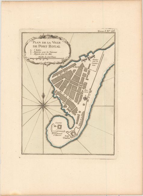
Precariously perched on the end of an unstable sand spit, Port Royal was a bustling international trading center. In the late 17th century, Port Royal was the largest and most economically important English settlement in the Americas. It was also called the wickedest city in the world for its accommodation of privateers, pirates, gambling houses and brothels. In 1692, an earthquake destroyed two-thirds of the city and by the time this map was published its importance had waned and Kingston was founded across the harbor. This bird's-eye plan of Port Royal shows Ft. Charles controlling the entrance. Details include names of individual streets and important buildings. A rococo-style cartouche, rhumb lines, and compass rose with a fleur-de-lys adorn the design.
References: Kapp (MCC-42) #78D; Sellers & Van Ee #1951.
Condition: A+
A clean, bright example on watermarked paper with wide margins.