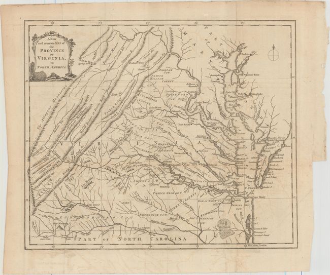
Subject: Virginia
Period: 1779 (published)
Publication: Universal Magazine
Color: Black & White
Size:
13.4 x 11.2 inches
34 x 28.4 cm
This scarce map is from the Universal Magazine's series of the American colony maps published during the American Revolution. It covers the region from Chesapeake Bay to the Allegany Mountains. Details include towns, watershed, waterfalls, bridges, plus many early place-names. Some land parcels are identified by owner's name. Relief in the mountains is fully engraved with the Blue Ridge, North Ridge or Devils Back, the Allagany Mountains and more identified. Counties are named but their boundaries are not delineated. Title is in a simple landscape-style cartouche and there is a simple compass rose with fleur-de-lys. Published in the December, 1779 issue of this London-based magazine.
References: Jolly #UNIV-183; Sellers & Van Ee #1444.
Condition: B+
Issued folding on watermarked paper with light offsetting, a couple of mis-folds, and a binding trim at right, far from image.