Subject: Utah
Period: 1858 (dated)
Publication:
Color: Hand Color
Size:
7.5 x 9.5 inches
19.1 x 24.1 cm
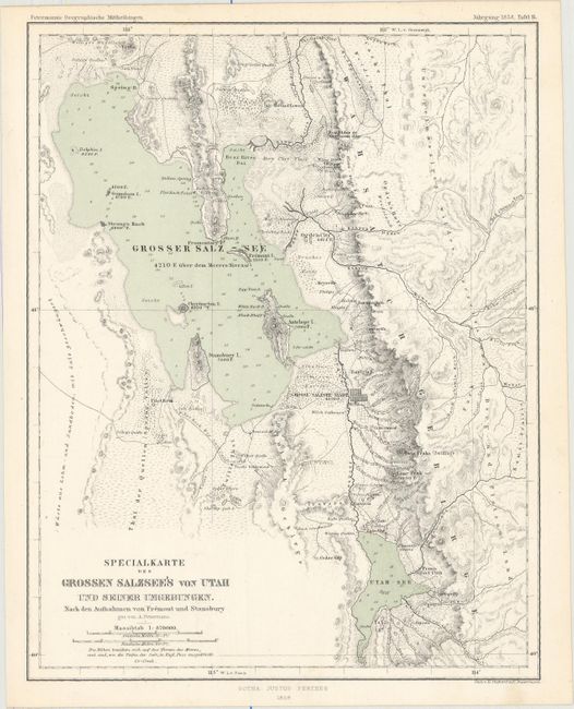
Early map of the central portion of Utah along the Wasatch Mountains. Centered on Salt Lake City, the map extends to the nascent Mormon communities of Ogden City, Brighams City and south to well below Provo. Brighams City is alternately here called Box Elder, a reference to the creek and early fort of the same name. South of Salt Lake City the Welsh Settlement is located. Also locates Tooele Settlement, Farmington, Keysville, but it does not name Logan though it appears to extend far enough. Shows all of the Great Salt Lake including Antelope Island and extends east beyond the spine of the mountains to show good detail of the many creeks and rivers in the vicinity of Park City.
Dr. Augustus Herman Petermann's Geographische Mittheilungen was the oldest German trade magazine dedicated to geography. First published in 1855, the magazine covered many of the important discoveries of the 19th and 20th century until its end in 1937. Published by Justus Perthes in Gotha.
References:
Condition: A+
Clean and bright with original color.