Subject: Ohio
Period: 1813 (published)
Publication: The Weekly Register
Color: Black & White
Size:
8.6 x 5 inches
21.8 x 12.7 cm
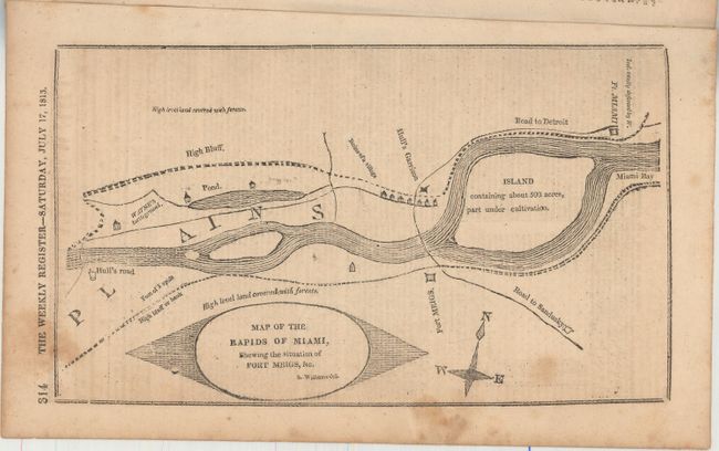
This uncommon map of the Miami River (Maumee River) shows Fort Meigs and Fort Miami as well as other details important to the military campaigns of the War of 1812. Fort Meigs was a supply depot and staging point for U.S. operations on the western frontier. The British and their Indian allies, operating out of Fort Miami, attempted to take over Fort Meigs twice but eventually had to retreat to the north.
The map is still bound into the 14-page, July 17th, 1813 edition of the Weekly Register. The magazine has several interesting articles including one on the front cover entitled "Republic of Mexico" which discusses Texas independence and several others concerning the War of 1812.
References:
Condition: B+
Map and text are very good with light toning and soiling.