Catalog Archive
Auction 155, Lot 288

"Asher & Adams New Topographical Atlas and Gazetteer of New York. Putnam, Rockland, Westchester, New York, Richmond, Kings, Queens, and Suffolk Counties", Asher & Adams

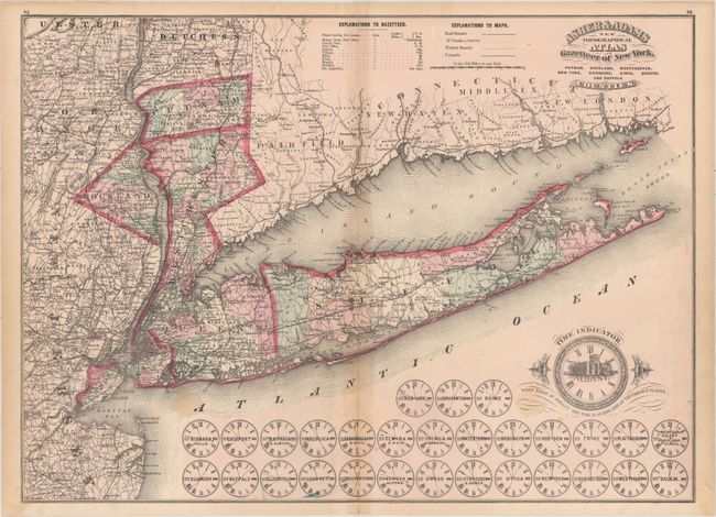
Subject: Southeastern New York

Period: 1870 (circa)

Publication: Asher & Adams New Topographical Atlas and Gazetteer of New York...

Color: Hand Color

Size:
22.4 x 16.3 inches
56.9 x 41.4 cm
Download High Resolution Image
(or just click on image to launch the Zoom viewer)

This striking map covers the region of Downstate New York, which includes Manhattan, Long Island, and nearby counties Putnam, Rockland, and Westchester. Neighborhoods are delineated, and towns, railroads, canals, post offices, wagon roads, harbors, and more are located. Bordering parts of New Jersey, Pennsylvania, and Connecticut are visible as well. At the bottom of the map is a "time indicator" comparing the time in Albany with the times in 29 nearby towns.

References:

Condition: B

Original color with light toning along the centerfold and sheet edges. There are short centerfold separations confined to the top and bottom blank margin and a few light stains.

Estimate: $200 - $240

Sold for: $150

Closed on 11/18/2015

Archived