Catalog Archive
Auction 155, Lot 279

"A New Map of New Hampshire", Belknap, Jeremy

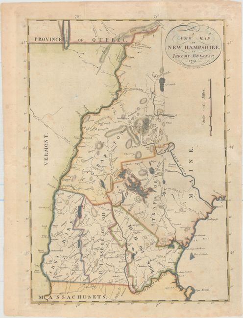
Subject: New Hampshire

Period: 1791 (dated)

Publication: History of New Hampshire Vol. II

Color: Hand Color

Size:
10.1 x 14.5 inches
25.7 x 36.8 cm
Download High Resolution Image
(or just click on image to launch the Zoom viewer)

This scarce map shows surprising detail and delineates five counties. According to Wheat & Brun this is the second state, with the area of Dartmouth College lands listed at 40,960 acres, revised from 42,000 on the first state, making the publication date 1812 or 1813. Many portages are shown, but no roads. The Line of Mason's Patent 17787 is marked. Lake Memfrimagog is mostly in Quebec. Engraved by S. Hill.

References: Wheat & Brun #183.

Condition: B

Issued folding, now pressed with an archivally repaired tear that enters 2.5" into map at right and some light scattered foxing.

Estimate: $325 - $400

Sold for: $240

Closed on 11/18/2015

Archived