Subject: Mississippi
Period: 1805-41 (circa)
Publication:
Color:
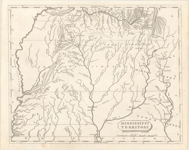
A. Mississippi Territory, by Arrowsmith & Lewis, circa 1805, black & white (9.8 x 7.9"). This is a small, but significant map of Mississippi Territory, covering the region of present-day Mississippi and Alabama. At the extreme northwest corner of the map is Fort Pickering on Chickasaw Bluff, near the future site of Memphis. Just below is a region labeled Upper Mississippi Company, and east of there, the Tennessee Company takes in the Tennessee River watershed in northern Alabama. Georgia Company occupies the middle of the map. Numerous Indian tribes and villages are located and Indian Paths, including the Natchez Trace are shown throughout. There are a number of forts located including Ft. Stoddert on the Mobile River, Ft. Adams on the Mississippi, and Ft. McHenry at Walnut Hills, later the site of Vicksburg. Drawn by Samuel Lewis and engraved by D. Fairman. Ref: Phillips (Atlases) #702-54. Condition: A crisp impression on a clean sheet with two tiny infilled holes along the bottom border.
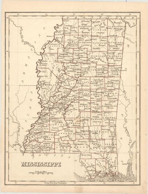
B. Mississippi, by Anonymous, circa 1842, hand color (7.8 x 9.9"). This map is likely from a later edition of Bradford's Comprehensive Atlas. The map is circa 1842 as Harrison County, founded in 1841, appears along the Gulf Coast. A total of 49 counties and two undesignated areas are depicted with a growing network of wagon roads connecting towns and settlements. Condition: One faint spot in the image and faint soiling in the bottom blank margin.
References:
Condition: A
See description above.