Subject: Michigan, Wisconsin
Period: 1845 (dated)
Publication:
Color: Hand Color
Size:
44.8 x 35.8 inches
113.8 x 90.9 cm
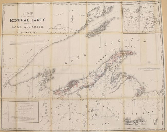
The subtitle continues, "Comprising that District between Chocolate River and Fond du Lac under the superintendency of Gen. John Stockton, U.S. Agent." This uncommon map was compiled partly from explorations made in 1844 by the Mineral Lands Agency at Copper Harbor, partly from a map published by S.D.U.K., and drawings from U.S. Surveys by Dr. Houghton, W.A. Burt, Nicollet & Bayfield. Mineral tracts are located and numbered, with leased tracts indicated by hand coloring. It shows the trap range of northern Michigan, locations of the American Fur Company Posts and Catholic/Methodist Missions. Includes a large inset map of Lake Superior, and engraved view of Camp Gray near Talcott Harbor.
References:
Condition: B
Issued folding with light to moderate toning along the folds and a number of short fold separations that have been mostly closed on verso with archival tape.