Subject: Martha's Vineyard, Massachusetts
Period: 1833 (dated)
Publication: American Coast Pilot, 11th Ed.
Color: Hand Color
Size:
7.3 x 3.9 inches
18.5 x 9.9 cm
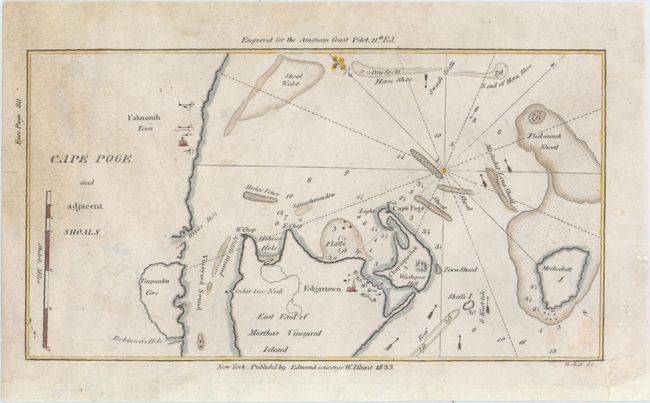
This small sea chart shows the eastern portion of Martha's Vineyard. Shoals, soundings, and arrows indicating the direction of the currents appear in the water. Cape Poge Light can be seen at the northeast tip of Chappaquiddick Island. Falmouth and Edgartown are named.
This map was published in the American Coast Pilot, a detailed guide to harbors, capes and headlands on the east coasts of North and South America including information on winds, currents, tides as well as latitudes and longitudes. The American Coast Pilot was published in 21 editions between 1796 and 1861, until it was replaced by federally-funded charts produced by the US Coast Survey.
References:
Condition: B+
Light soiling and a few archivally repaired edge tears, only one of which enters the image and has been closed with archival tape.