Catalog Archive
Auction 155, Lot 270

"Map of the Metropolitan District of Boston Massachusetts Showing the Existing Public Reservations and Such New Open Spaces As Are Proposed by Charles Eliot, Landscape Architect…",

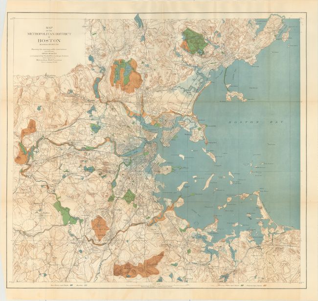
Subject: Boston, Massachusetts

Period: 1893 (dated)

Publication: Boston Metopolitan Park Commission

Color: Printed Color

Size:
25 x 23.5 inches
63.5 x 59.7 cm
Download High Resolution Image
(or just click on image to launch the Zoom viewer)

A large and very detailed map drawn on a scale of approximately one mile per inch. The map represents the beginning of the expansion of the Boston park system in 1893. It covers the region from below Dedham north to show all of Marblehead, east to include Nantasket and west beyond Riverside. Open spaces are shown in brown on the map. The map is accompanied by two sheets of text including "Key To Figures on the Map" (naming 106 places of interest shown on the map) and "Notes on the Map" (discussing the open spaces, both existing and as proposed by the architect). Established in 1893, the Metropolitan Park Commission worked to preserve the region's unique landscapes by acquiring and protecting park lands, river corridors and coastal areas.

References:

Condition: B+

Issued folding with faint color offsetting and a few minor stains along the bottom border at right.

Estimate: $200 - $230

Sold for: $275

Closed on 11/18/2015

Archived