Subject: Boston, Massachusetts
Period: 1847 (dated)
Publication: American Coast Pilot
Color: Black & White
Size:
10.3 x 8.2 inches
26.2 x 20.8 cm
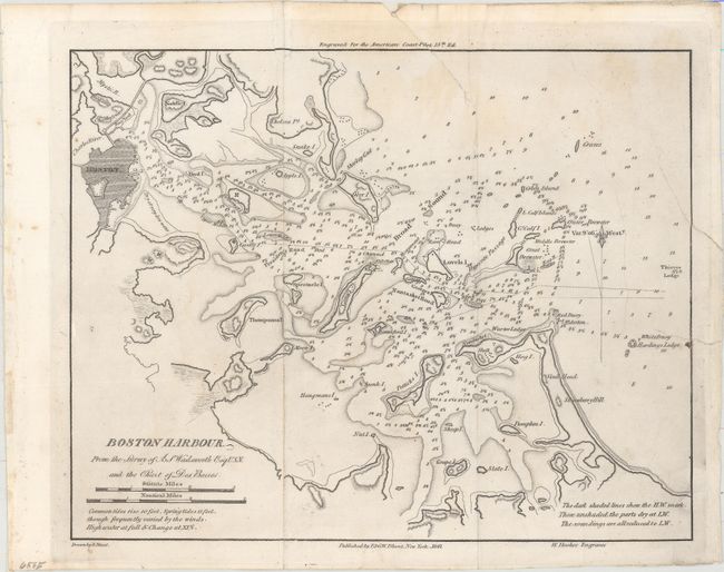
This chart gives excellent navigational detail of Boston Harbor, with soundings, rocks, shoals, anchorages, and lighthouses noted. The chart was based on earlier surveys, including a US Navy survey from 1817 and British surveys from the Revolutionary War period. Drawn by Edmund Blunt and engraved by Hooker.
This map was published in the American Coast Pilot, a detailed guide to harbors, capes and headlands on the east coasts of North and South America including information on winds, currents, tides as well as latitudes and longitudes. The American Coast Pilot was published in 21 editions between 1796 and 1861, until it was replaced by federally-funded charts produced by the US Coast Survey.
References:
Condition: B
Issued folding and now pressed and backed with tissue to reinforce and repair a small chip that just enters the border at top, a tear that enters 1.5" at top, and another tear that extends 1.5" into the image at right. Light extraneous creasing and minor soiling.