Subject: Washington, D.C.
Period: 1882-90 (circa)
Publication:
Color: Black & White
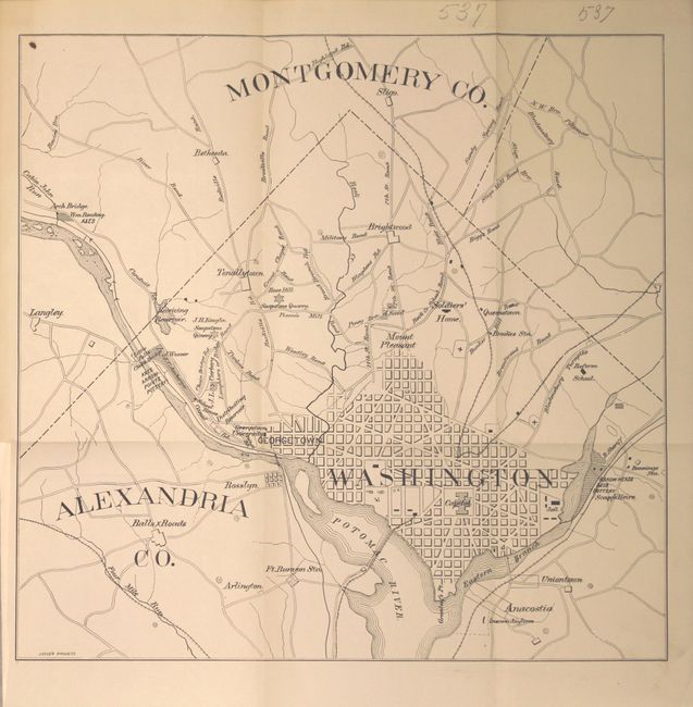
A. [Map of Antiquarian Sites, District of Columbia], by Louis A. Kengla, circa 1882 (11.9 x 11.4"). This map of the District extends to include portions of Alexandria and Montgomery counties and shows the location of pottery, axes, arrowheads, quarries and some land ownership information. The map is bound into a book only containing blank sheets of paper. Octavo, hardbound in quarter leather with tips over marbled boards. Condition: The map is clean and bright with a few pencil notations in the top blank margin. Covers are somewhat loose with light wear and the spine is cracked at bottom. Contains a Library of Congress "surplus duplicate" stamp on one of the blank pages.
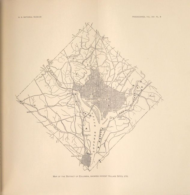
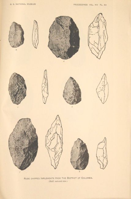
B. Map of the District of Columbia, Showing Ancient Village Sites, Etc., by the Department of the Interior, published 1890 (7.3 x 7.3"). This small map shows ancient village sites around the District, primarily along the Anacostia River. Includes four fossil plates and an 8 pp. article entitled "A Collection of Stone Implements From the District of Columbia." Paper wrappers. Condition: Map and plates are fine. Paper wrappers are faded and partially detached at top. Withdrawn stamp on front wrapper.
References: Phillips (Maps and Views of DC) #PW293.
Condition: A
See description above.