Subject: San Diego, California
Period: 1857 (dated)
Publication:
Color: Black & White
Size:
20.4 x 26.9 inches
51.8 x 68.3 cm
The Office of Coast Survey is the oldest U.S. scientific organization, dating from 1807 when Congress directed that a "survey of the coast" be carried out. By 1836, it was called the U.S. Coast Survey and in 1878, the name was changed to the U.S. Coast and Geodetic Survey. Today the Office of Coast Survey is a division of the National Oceanic and Atmospheric Administration NOAA.
The survey teams, composed of civilians as well as Army and Naval officers, charted the nation's waterways and produced a wide array of reports, survey charts, hydrographic studies of tides and currents, astronomical studies and observations, and coastal pilots. These charts are an important record of the changing nature of the nation's coastlines. In additional to coastal charts, the U.S. Coast and Geodetic Survey produced land sketches, Civil War battle maps, and the early aeronautical charts.
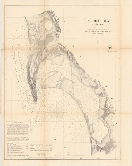
An important, early San Diego nautical map covering the region from Mission Bay to the border of Mexico. Sailing directions, soundings, and topographical features are illustrated and noted. This is the largest map of San Diego Bay produced by the Coast Survey - earlier editions published from 1850-53 were about half this size.
References:
Condition: B+
Issued folding and now flattened and backed with tissue. There is light toning along the folds and a few spots of foxing. A binding trim at top left has been replaced with old paper.