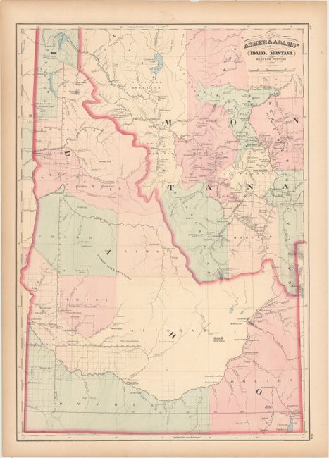
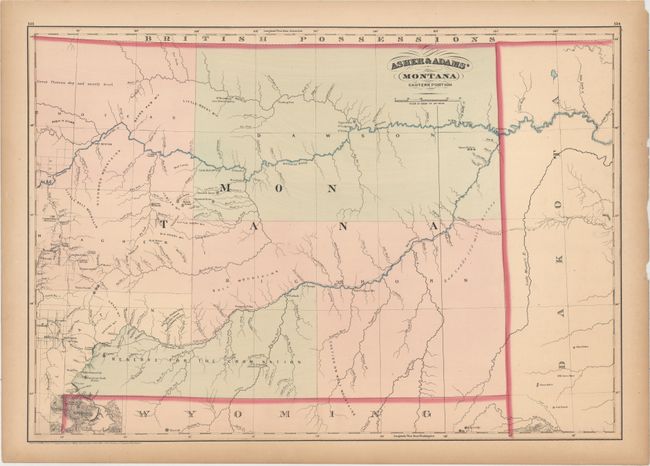
Subject: Idaho, Montana
Period: 1874 (dated)
Publication:
Color: Hand Color
A. Asher & Adams' Idaho. Montana Western Portion, (16.0 x 22.6"). Attractive double-page map showing the extent of surveying which was limited to the western border of Idaho including Boise and Lewiston and portions of Montana in the vicinity of Bozeman and Helena. Delineates nine counties in Idaho including the large Alturas County in the southern portion of the state. The Northern Pacific Railroad proposed route is prominently depicted through both states.
B. Asher & Adams' Montana Eastern Portion, (22.8 x 15.9"). Another double-page map focused on the eastern half of Montana Territory. Depicts five large counties and a "Reserve for the Crow Nation." Shows the proposed path of the Northern Pacific Railroad, the Yellowstone and Missouri rivers, and limited surveying on the western edge of the sheet.
References:
Condition: B+
Original color with light toning primarily along sheet edges. There are a few tiny edge tears and chips confined to the blank margins.