Subject: Central United States
Period: 1858 (dated)
Publication: Geographische Mittheilungen
Color: Hand Color
Size:
9.6 x 7.5 inches
24.4 x 19.1 cm
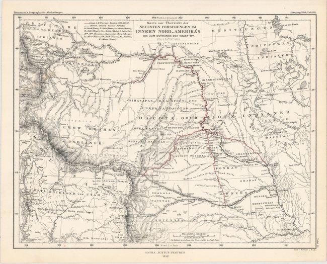
Very attractive and finely engraved map showing Lt. G.K. Warren's routes in 1855 and 1856. Warren's tracks are highlighted as they traverse the Northern Plains between the Missouri River and the Rockies. The map extends to the Wasatch Mountains and the Green River in the southwest and the Chippeway Indian land and Rainy Lake in the northeast. It locates numerous forts and Indian lands. Watershed and topographical details include the elevations of river basins, plains and countless mountain peaks.
Dr. Augustus Herman Petermann's Geographische Mittheilungen was the oldest German trade magazine dedicated to geography. First published in 1855, the magazine covered many of the important discoveries of the 19th and 20th century until its end in 1937. Published by Justus Perthes in Gotha.
References:
Condition: A
On a clean sheet with original outline color and a few small faint spots.