Subject: Central United States
Period: 1858 (dated)
Publication:
Color: Black & White
Size:
21.2 x 19.1 inches
53.8 x 48.5 cm
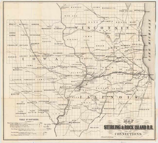
This map depicts the proposed railroad between Sterling and Rock Island, Illinois. Due to a number of problems, most notably the onset of the Civil War, the railroad was never built under that name. Many locals mortgaged their property to support these early efforts only to have their efforts end in disaster. In 1869 a railroad was constructed but called the "Rockford, Rock Island & St. Louis Railroad." The map itself is delineated by county and covers northern Illinois, Southern Wiscosin, and Eastern Iowa and depicts numerous other railroads, rivers, towns and cities. Includes a 24-page prospectus. No other copies have been located in auction results or dealer listings in the last 30 years.
References:
Condition: B+
A mostly clean example that has been trimmed to the neatline at right, having been removed from the pamphlet. Text is very good with minor soiling.