Subject: Central United States
Period: 1796 (circa)
Publication: The American Universal Geography
Color: Black & White
Size:
9.5 x 7.4 inches
24.1 x 18.8 cm
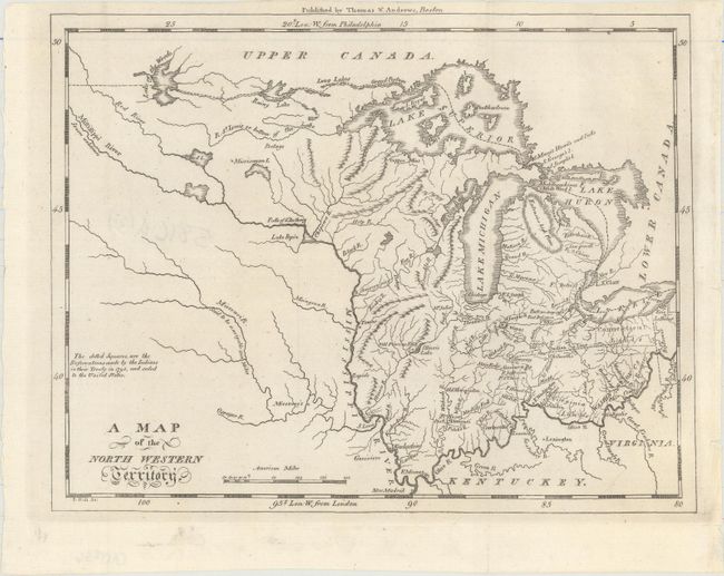
This early and fascinating map primarily describes the area between the Ohio and Mississippi Rivers, detailing watershed and many forts. Indian lands ceded to the United States as part of the Treaty of 1795 are identified in Ohio. A huge area referred to as Extensive High Plains appears in northern Michigan. The fictitious Bellin-Charlevoix islands are shown in Lake Superior, the Indian Line is delineated, and the Connecticut and Virginia Lands are identified. The Mississippi River is labeled Source Unknown. The Missouri River is "Said to be navigable 1300 Miles." Frontier villages include St. Louis, Tawas, and Kaskaskias. A copper mine is noted in today's Upper Peninsula. Only four of the Great Lakes are shown with Ontario off the map. On the southwest shore of Illinois Lake is Old Priorias F & V. An early map that was published in Boston by Thomas & Andrews. Engraved by Samuel Hill.
References: McCorkle (18th C. Geography) #304-11; Wheat & Brun #679.
Condition: A
Issued folding.