Subject: Southern United States, Civil War
Period: 1891-95 (published)
Publication: Atlas to Accompany the Official Records of the Union and Confederate Armies...
Color: Printed Color
Size:
27.3 x 16.4 inches
69.3 x 41.7 cm
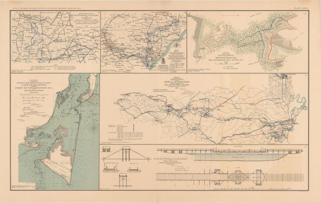
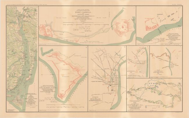
This lot of informative Civil War maps comes from the government's comprehensive atlas covering the War Between the States. These plates were issued between 1891 and 1895 to accompany the Official Army Records and were published under the Secretaries of War Redfield Proctor, Stephen B. Elkins, and Daniel S. Lamont by Maj. Gen. George B. Davis, assisted by civilian experts Leslie Perry and Joseph Kirkley. The first sheet contains six sections, the largest showing the Army of the Potomac near the end of the war. The other sections depict the march of the Union Army's Calvary Corps through Mississippi, Alabama, and Georgia; General Sherman's route from Atlanta to Goldsborough, North Carolina; a battleground in the swamps of South Carolina; a chart detailing the blockade of Cape Fear River and the port at Wilmington; and the blueprints for a bridge over the James River in Virginia. The second sheet features eight maps, including four focusing on Confederate movement and fortifications on the Cape Fear River in North Carolina, two showing the Confederate defenses in Augusta, Georgia, one outlining fortifications in Columbus, Georgia, and one detailing the battlefield at Champion's Hill, Mississippi. Size varies slightly.
References:
Condition: B+
Light toning and color offsetting with a few minor spots on the second map.