Subject: North Carolina & South Carolina
Period: 1804 (circa)
Publication: A New and Elegant General Atlas...
Color: Black & White
Size:
9.8 x 7.9 inches
24.9 x 20.1 cm
Shortly after the turn of the century, Samuel Lewis joined with Aaron Arrowsmith (an English map publisher) to produce A New and Elegant General Atlas. The title page states the maps are "intended to accompany the new improved edition of Morse's Geography…" Several editions were published from 1804-1819. This lot includes the following maps from this atlas:
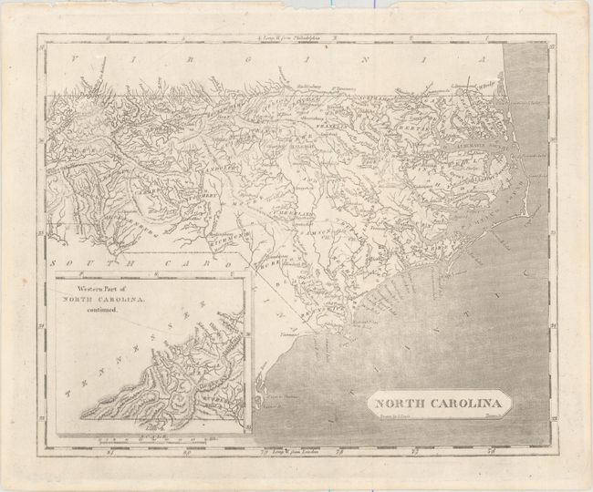
A. North Carolina. This early map shows the state with an inset "Western Part of North Carolina continued" at left. All towns and villages, counties, roads, and extensive watersheds are detailed. The map is current to 1798, prior to Glasgow County's name change to Greene in 1799. Drawn by Samuel Lewis and engraved by Tanner.
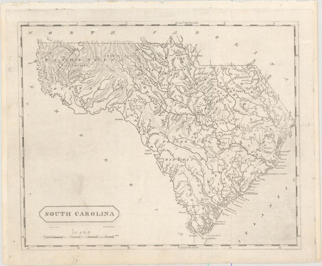
B. South Carolina. This map shows an interesting combination of both judicial districts and counties within the state. Washington District occupies the western portion of the state with an Indian Boundary extending into North Carolina. Locates towns and villages, a few wagon roads, rivers and topography. Drawn by Samuel Lewis and engraved by D. Fairman.
References: Phillips (Maps) p. 616 & p. 827; Phillips (A) #702.
Condition: A
Minor printer's ink residue.